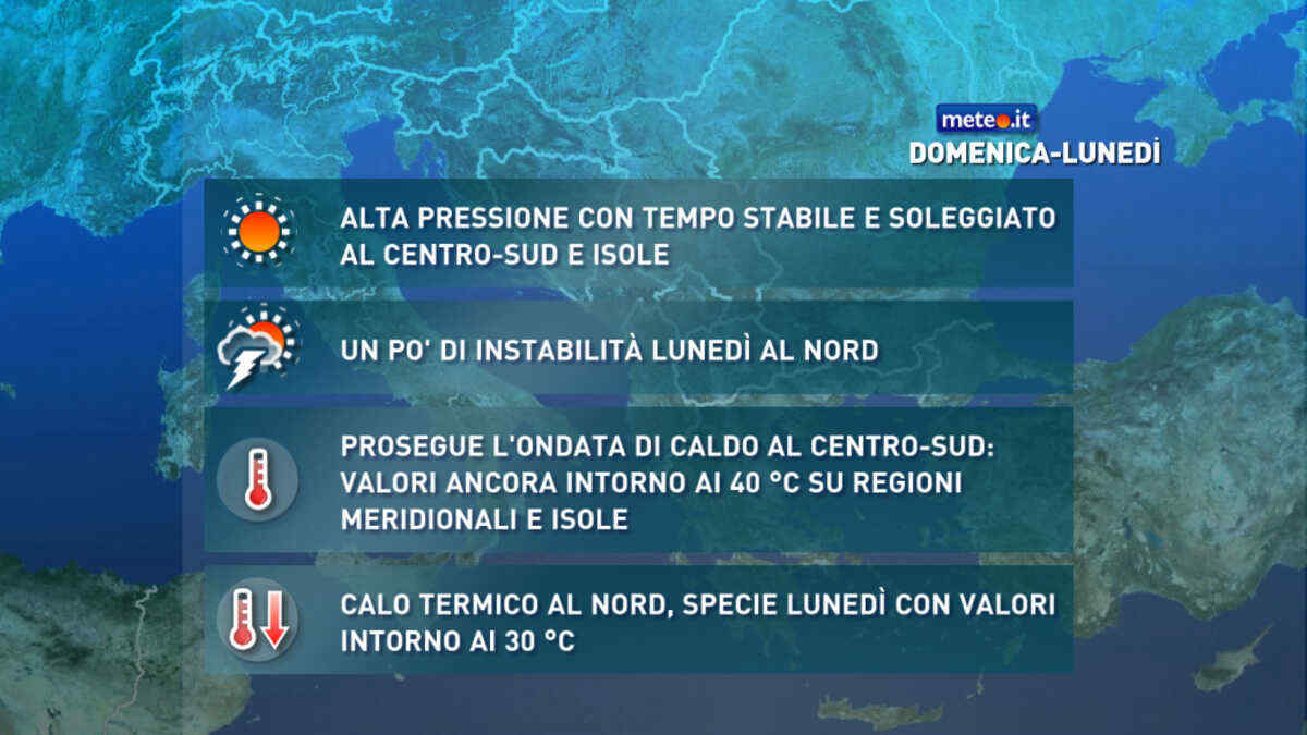
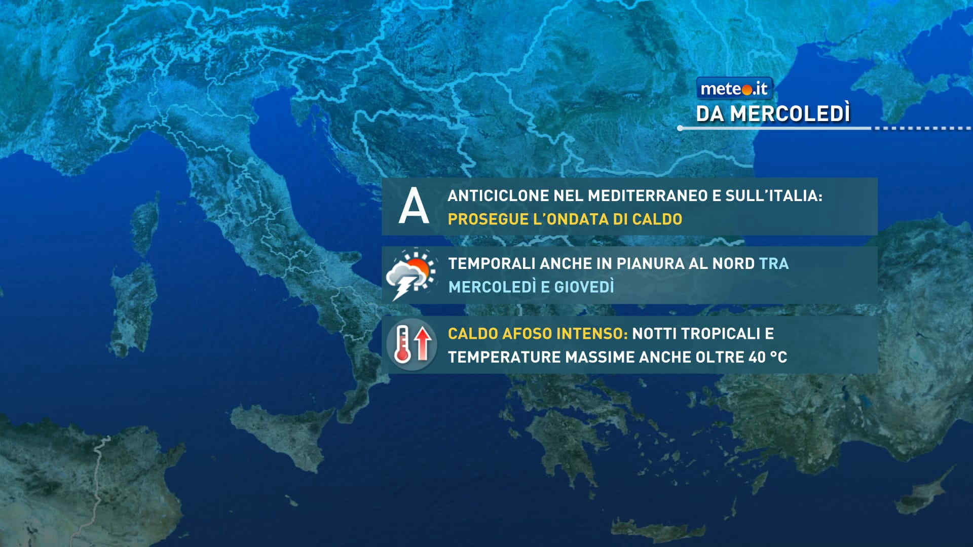
Al mattino ben soleggiato in tutte le regioni. Temperature minime stabili o in lieve aumento. Nel pomeriggio tempo ancora prevalentemente soleggiato, con un temporaneo aumento della nuvolosita' lungo l'Appennino. Temperature massime in aumento di 1-3 gradi; clima sempre molto caldo con valori dai 33 a punte a sfiorare i 40 gradi nelle conche interne. Venti per lo piu' deboli con locali e temporanei rinforzi sui mari che saranno comunque poco mossi.
Meteo, stop all'ondata di caldo: aria più fresca in arrivo, ecco quando
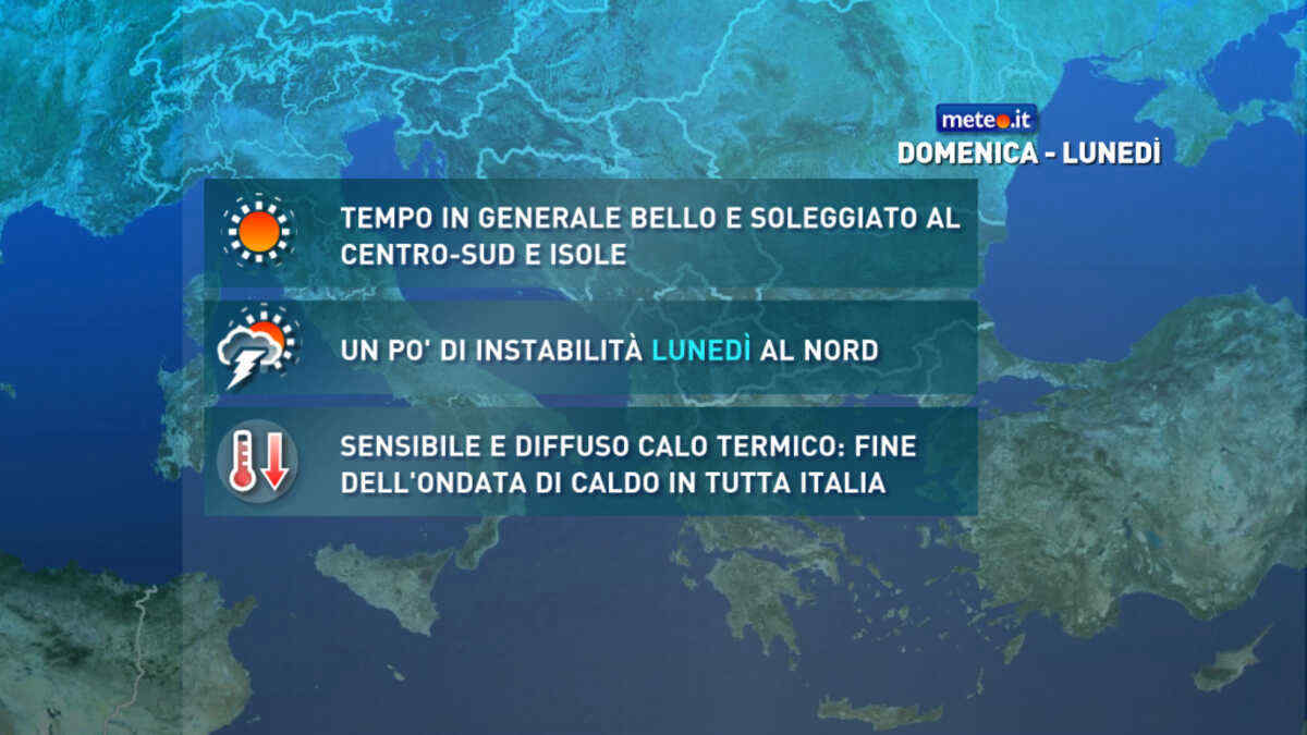
Calo delle temperature a partire da lunedì 20 luglio al Nord ed entro giovedì anche al Sud. Venti settentrionali più freschi spazzeranno via l'afa. La tendenza meteo
Meteo, stop all'ondata di caldo: da domenica 19 luglio sensibile calo termico
A partire dal 19 luglio si interromperà la lunga e intensa ondata di caldo afoso sull'Italia per l'arrivo di correnti relativamente più fresche e instabili. La tendenza meteo


 0
0 57%
57% 9-19 Km/h
 Nord NE
 Nord NE
 Nord
Nord
 Nord NO
 6
6 Nord
Nord Nord E
 Est NE
 75%
75% Est
Est