Al mattino cielo sereno o poco nuvoloso, con qualche addensamento piu' compatto nelle Alpi settentrionali a inizio giornata. Temperature minime stazionarie o in lieve crescita, sempre molto elevate. Nel pomeriggio nubi in aumento sui rilievi e in Piemonte, maggiori schiarite altrove. Sviluppo di rovesci e temporali sparsi sulle Alpi, insistenti anche alla sera nel settore centrale; non si escludono brevi precipitazioni anche sull'Appennino ligure. Temperature massime quasi stazionarie, salvo locali rialzi per lo piu' in Lombardia; caldo intenso e afoso, con punte intorno ai 34-37 gradi. Venti a regime di brezza; possibili raffiche in prossimita' dei temporali. Mar Ligure calmo o poco mosso.
Meteo, quanto terminerà questa ondata di caldo africano? La tendenza
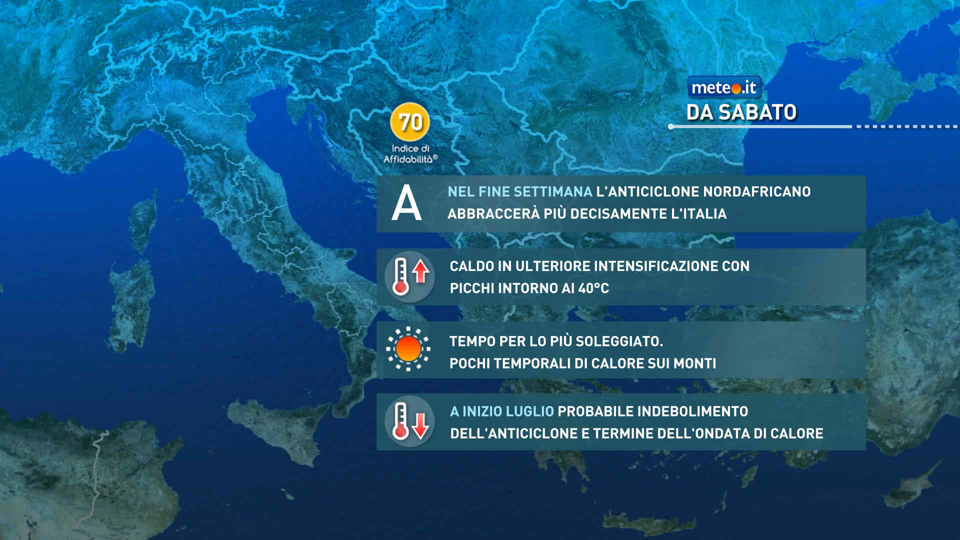
Anticiclone nord-africano protagonista fino alla fine del mese di giugno. A inizio luglio possibile afflusso di aria più fresca e instabile ma attenzione al rischio di violenti temporali.. La tendenza


 0
0 42%
42% 16-34 Km/h
 Nord NE
 Nord E
 Nord
Nord 6
6 Nord NO
 Nord O
 Ovest NO
 Ovest
Ovest Sud O
Sud O Ovest SO