Al mattino cielo sereno o poco nuvoloso. Temperature minime in aumento. Nel pomeriggio tempo per lo piu' soleggiato e molto caldo. Nelle zone interne montuose temporaneo aumento della nuvolosita' cumuliforme con occasionali rovesci. Temperature massime in aumento nell'ovest dell'isola; punte attorno ai 40 gradi. Venti da sud-sudest, localmente moderati nel canale che sara' localmente mosso. Per lo piu' poco mossi gli altri mari.
Meteo, prossima settimana prosegue la severa ondata di calore
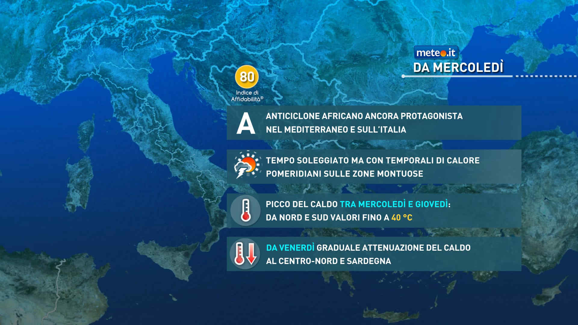
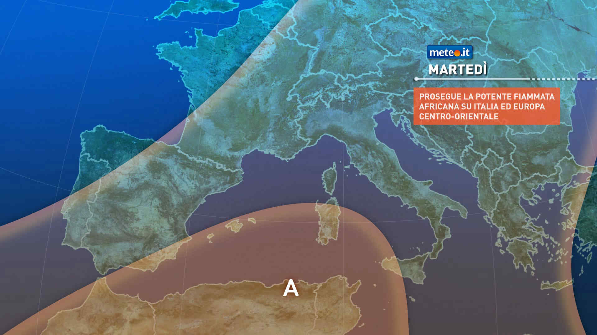
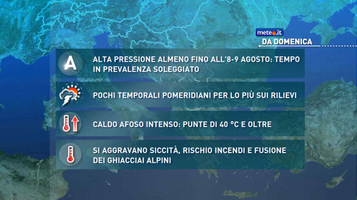
La calura con dà tregua: le temperature elevate saranno ancora una costante con tutti i disagi conseguenti per l’organismo e l’ambiente. Afa e notti tropicali
Meteo, il caldo opprimente proseguirà anche la prossima settimana
La situazione rimarrà critica sul fronte della siccità, rischio incendi e sofferenza per i ghiacciai con lo zero termico ben oltre 4500 metri. Afa e notti tropicali


 0
0 41%
41% 11-17 Km/h
 Ovest NO
 Ovest
Ovest Ovest SO
 7
7 Ovest SO
 Sud O
Sud O Sud SO
 Sud SE
 Sud
Sud Ovest
Ovest