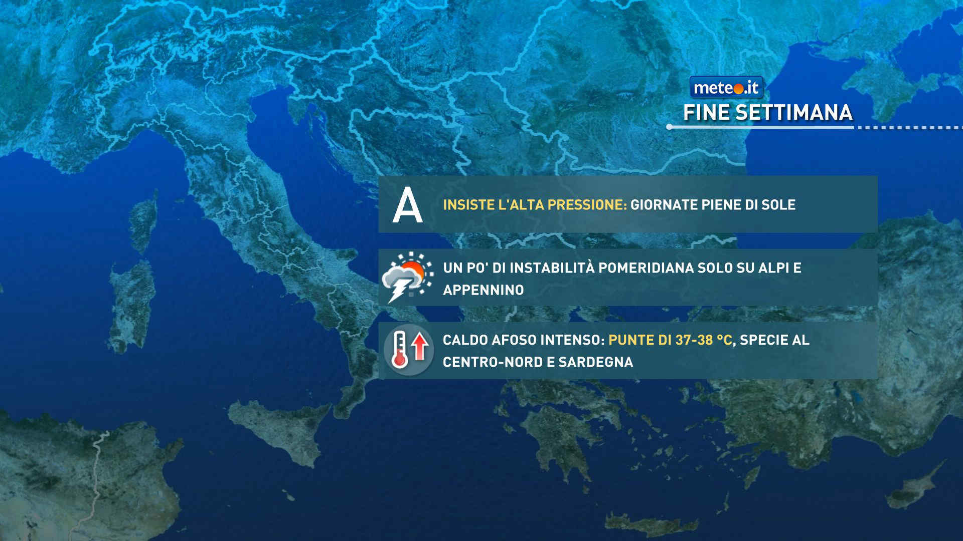
Al mattino cielo sereno o poco nuvoloso. Temperature minime in aumento. Nel pomeriggio tempo generalmente soleggiato e caldo. Possibili temporali isolati nelle zone interne della Calabria. Temperature massime stazionarie o lieve rialzo. Venti per lo piu' deboli. Mari poco mossi o calmi.
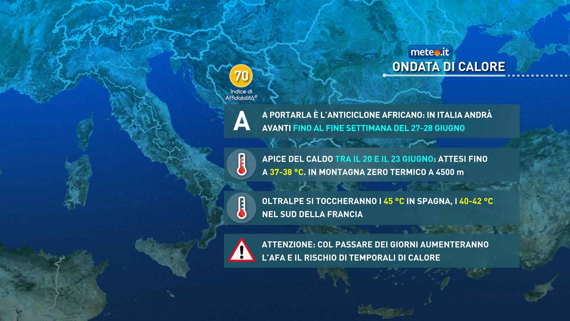
Meteo, dal 21 giugno (Solstizio) fase più intensa dell'ondata di caldo: la tendenza
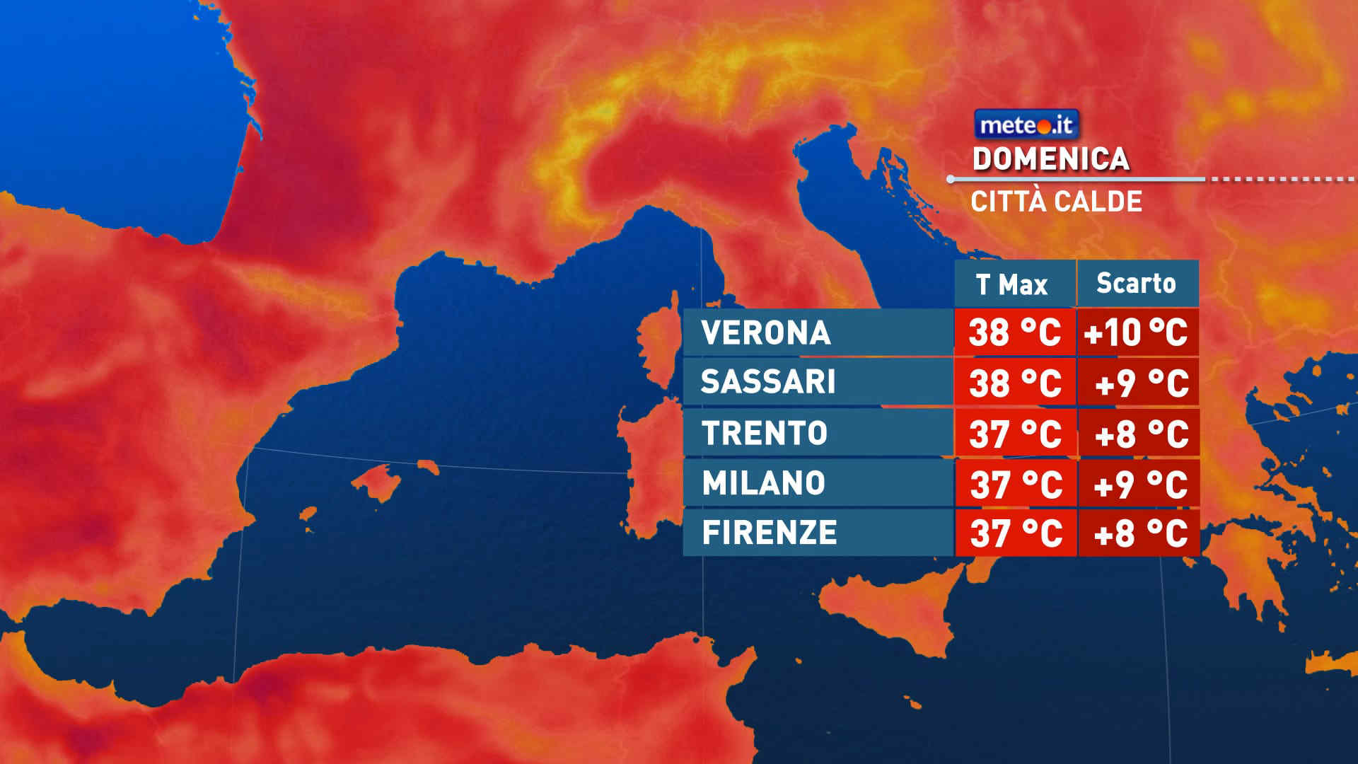
Da domenica 21 giugno e per tutta la prossima settimana prosegue l'intensa ondata di caldo portata dall'Anticiclone nord-africano. Afa in aumento e notti tropicali. La tendenza meteo


 0
0
 63%
63% 8-13 Km/h
 Ovest SO
 Ovest
Ovest Ovest NO
 Nord O
 Nord NO
 Nord NE
 Nord E
 Est NE
 6
6 Est SE
 Est
Est Nord
Nord