FacebookInstagramXWhatsApp

Meteo Petilia Policastro tra 8 giorni. Previsioni del tempo, precipitazioni, temperatura e venti

FacebookWhatsappXTelegram

Petilia Policastro
Notte
sereno notte
Mattino
soleggiato
Pomeriggio
prevalentemente soleggiato
Sera
sereno notte
  • 16°

    UV Normale 0

    ore

    poco nuvoloso

    Umidità normale52%

    Raffiche forti33-51 Km/h

    Ovest nord ovest intensoOvest NO

  • 16°

    UV Normale 0

    ore

    sereno notte

    Umidità normale50%

    Raffiche forti28-45 Km/h

    Ovest nord ovest intensoOvest NO

  • 15°

    UV Normale 0

    ore

    sereno notte

    Umidità normale48%

    Raffiche forti24-39 Km/h

    Ovest nord ovest intensoOvest NO

  • 15°

    UV Normale 0

    ore

    sereno notte

    Umidità normale46%

    Raffiche forti20-33 Km/h

    Ovest nord ovest intensoOvest NO

  • 14°

    UV Normale 0

    ore

    sereno notte

    Umidità normale44%

    Raffiche forti17-30 Km/h

    Ovest nord ovest intensoOvest NO

  • 14°

    UV Normale 0

    ore

    sereno notte

    Umidità normale46%

    Raffiche forti15-27 Km/h

    Ovest nord ovest intensoOvest NO

  • 14°

    UV Normale 1

    ore

    soleggiato

    Umidità normale48%

    Raffiche forti12-23 Km/h

    Ovest nord ovest intensoOvest NO

  • 14°

    UV Normale 2

    ore

    soleggiato

    Umidità normale50%

    Raffiche forti10-20 Km/h

    Ovest nord ovest intensoOvest NO

  • 14°

    UV Normale 2

    ore

    soleggiato

    Umidità normale52%

    Raffiche normali8-17 Km/h

    Ovest nord ovestOvest NO

  • 14°

    UV Normale 3

    ore

    soleggiato

    Umidità normale54%

    Raffiche normali5-13 Km/h

    Ovest nord ovestOvest NO

  • 15°

    UV Normale 3

    ore

    soleggiato

    Umidità normale55%

    Raffiche normali6-13 Km/h

    OvestOvest

  • 16°

    UV Normale 4

    ore

    soleggiato

    Umidità normale56%

    Raffiche normali6-13 Km/h

    Ovest sud ovestOvest SO

  • 17°

    UV Normale 4

    ore

    soleggiato

    Umidità normale57%

    Raffiche normali7-14 Km/h

    Sud sud ovestSud SO

  • 17°

    UV Normale 5

    ore

    prevalentemente soleggiato

    Umidità normale58%

    Raffiche normali7-14 Km/h

    SudSud

  • 18°

    UV Normale 4

    ore

    prevalentemente soleggiato

    Umidità normale59%

    Raffiche normali8-14 Km/h

    Sud sud estSud SE

  • 19°

    UV Normale 2

    ore

    prevalentemente soleggiato

    Umidità normale60%

    Raffiche normali9-14 Km/h

    Est sud estEst SE

  • 18°

    UV Normale 1

    ore

    prevalentemente soleggiato

    Umidità normale59%

    Raffiche normali7-13 Km/h

    Sud estSud E

  • 18°

    UV Normale 0

    ore

    poco nuvoloso

    Umidità normale58%

    Raffiche normali6-12 Km/h

    Sud estSud E

  • 17°

    UV Normale 0

    ore

    poco nuvoloso

    Umidità normale57%

    Raffiche normali5-10 Km/h

    Sud estSud E

  • 16°

    UV Normale 0

    ore

    sereno notte

    Umidità normale55%

    Raffiche normali4-9 Km/h

    Sud sud estSud SE

  • 16°

    UV Normale 0

    ore

    sereno notte

    Umidità normale54%

    Raffiche normali3-8 Km/h

    Sud sud estSud SE

  • 15°

    UV Normale 0

    ore

    sereno notte

    Umidità normale53%

    Raffiche normali1-6 Km/h

    SudSud

  • 15°

    UV Normale 0

    ore

    sereno notte

    Umidità normale54%

    Raffiche normali1-6 Km/h

    Sud sud estSud SE

  • 15°

    UV Normale 0

    ore

    sereno notte

    Umidità normale54%

    Raffiche normali1-5 Km/h

    Sud sud estSud SE

  • 14°

    UV Normale 0

    ore

    sereno notte

    Umidità normale55%

    Raffiche normali1-5 Km/h

    Sud sud estSud SE

Meteo provincia di Crotone
Meteo Sud Italia
Oggi

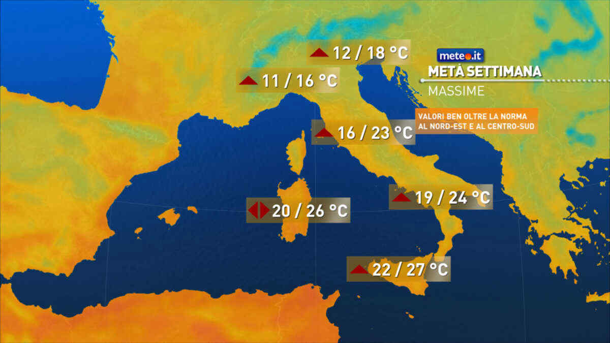
Al mattino sui settori ionici, in Puglia e nel sud della Calabria tempo abbastanza soleggiato. Nubi piu' dense nel resto del settore, associate a sporadiche piogge in Campania e sulla Basilicata tirrenica. Temperature minime in sensibile rialzo. Nel pomeriggio in Campania nuvolosita' irregolare; sulle altre regioni tempo abbastanza soleggiato. Temperature massime in aumento. Venti: per lo piu' deboli. Mari: mosso lo Ionio, in prevalenza poco mossi gli altri.

Ultime newsVedi tutte


Meteo, tra venerdì e il weekend tempo instabile e aria più fredda: la tendenza dal 13 novembre
Tendenza10 Novembre 2026
Meteo, tra venerdì e il weekend tempo instabile e aria più fredda: la tendenza dal 13 novembre
Arrivano venti più freddi da nord-est, con temperature in calo e nuove piogge: gli aggiornamenti meteo
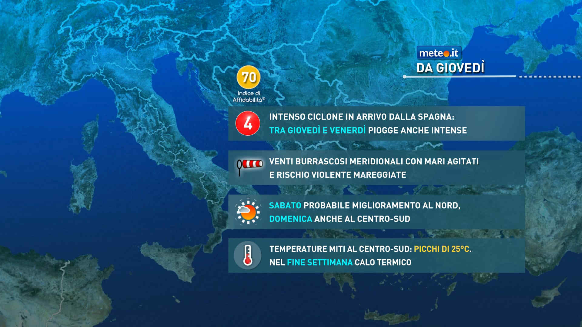
Meteo, tra giovedì 12 e venerdì 13 novembre, intensa fase di maltempo
Tendenza9 Novembre 2026
Meteo, tra giovedì 12 e venerdì 13 novembre, intensa fase di maltempo
Attese precipitazioni diffuse, insistenti, in grado di produrre consistenti accumuli di pioggia al Nord e nelle zone tirreniche. La massa d’aria rimarrà mite

Meteo: 12-13 novembre con forti piogge, venti e rischio criticità. Ecco dove
Tendenza8 Novembre 2026
Meteo: 12-13 novembre con forti piogge, venti e rischio criticità. Ecco dove
La tendenza meteo per la seconda parte della settimana vede l'arrivo di un'intensa perturbazione che potrebbe innescare un maltempo critico.
Mediaset

Ultimo aggiornamento Mercoledì 11 Novembre ore 05:50

Copyright © 1999-2020 RTI S.p.A. Direzione Business Digital - P.Iva 03976881007 - Tutti i diritti riservati.

Rispetto ai contenuti e ai dati personali trasmessi e/o riprodotti è vietata ogni utilizzazione funzionale all'addestramento di sistemi di intelligenza artificiale generativa. È altresì fatto divieto espresso di utilizzare mezzi automatizzati di data scraping.

Per la pubblicità Mediamond S.p.a. RTI spa, Gruppo Mediaset - Sede legale: 00187 Roma Largo del Nazareno 8 - Cap. Soc. € 500.000.007,00 int. vers. - Registro delle Imprese di Roma, C.F.06921720154