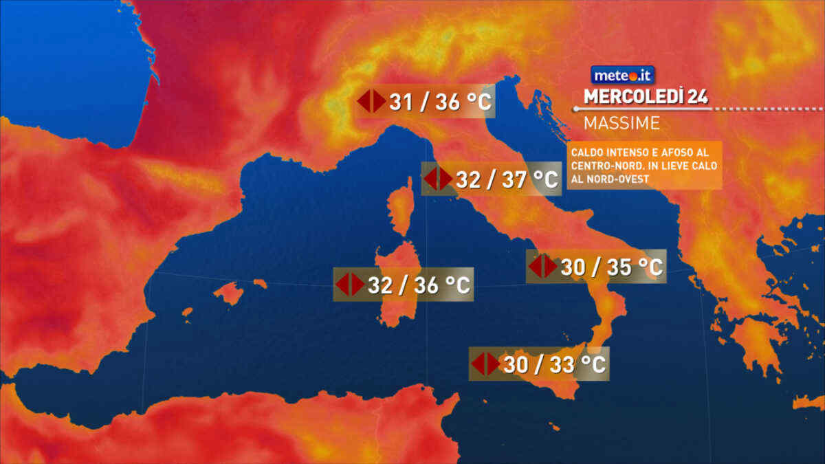
Al mattino cielo sereno in Alto Adige. Cielo poco o al piu' parzialmente nuvoloso nelle altre zone. Temperature minime stazionarie e su valori elevati, per lo piu' tra 20 e 26 gradi. Nel pomeriggio tempo generalmente soleggiato lungo le zone costiere e in parte anche sulle pianure. Sulle zone montuose sviluppo di nubi e isolati rovesci o temporali; in forma isolata qualche fenomeni sara' possibile anche sulle vicine pianure di Emilia e Veneto occidentale. Caldo moderato e afoso con temperature massime stazionarie o in lieve calo ma sempre elevate, fino a punte di 35-36 gradi nelle aree di pianura. Venti deboli, salvo temporanei rinforzi di brezza a meta' giornata specie lungo i litorali; possibili raffiche nelle aree temporalesche. Mare Adriatico calmo o poco mosso.
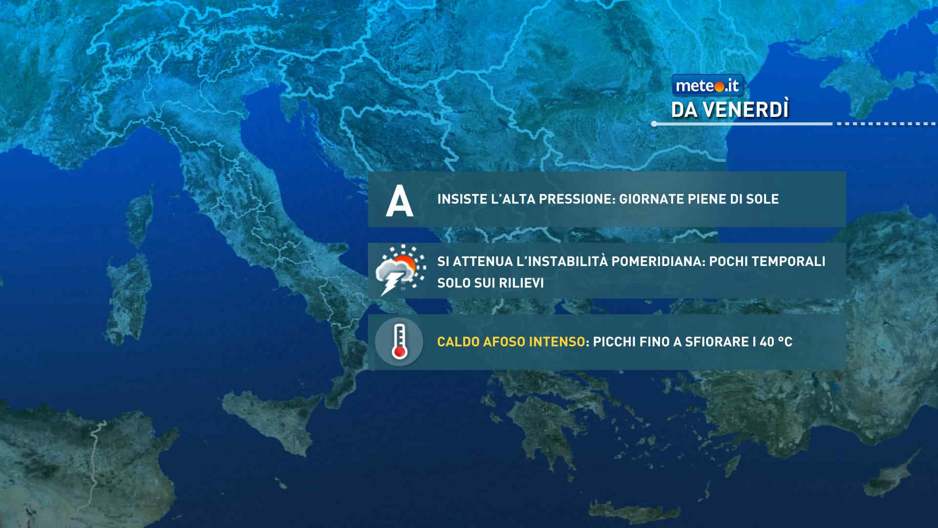
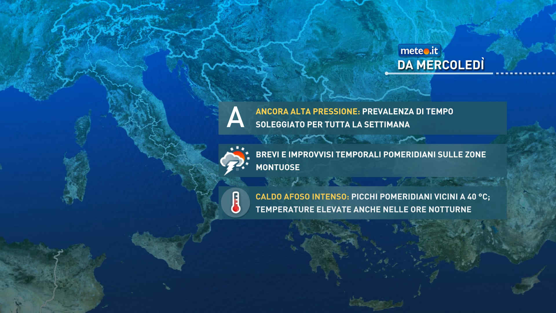
Meteo, ondata di caldo africano fino alla fine del mese: la tendenza
L'ondata di caldo africano in atto sarà particolarmente lunga: durerà almeno fino alla fine del mese e probabilmente fino a inizio luglio con temperature sopra la norma di 10 gradi. La tendenza meteo


 0
0
 55%
55% 12-28 Km/h
 Nord NE
 Nord
Nord 6
6 Nord NO
 Nord O
 Ovest NO
 Ovest
Ovest Ovest SO
 Ovest SO
 Ovest
Ovest Ovest NO
 Nord NO