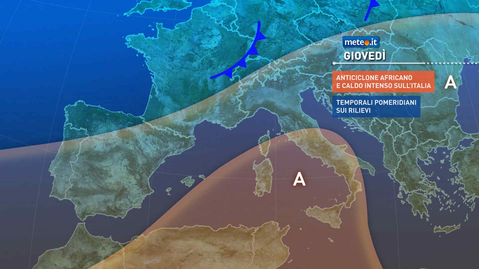
Al mattino cielo per lo piu' sereno o poco nuvoloso sulle pianure; qualche locale addensamento sul Trentino Alto Adige. Temperature minime stabili o in lieve calo. Nel pomeriggio tempo in prevalenza soleggiato, molto caldo e afoso. Attorno ai rilievi sviluppo di cumuli e possibilita' di brevi ed isolati rovesci o temporali di calore su Alto Adige ed Appennino emiliano occidentale. Temperature massime elevate, tra 34 e punte a sfiorare i 40 gradi. Venti deboli, sud-orientali sull'Adriatico con mare poco mosso.
Meteo, prossima settimana prosegue la severa ondata di calore
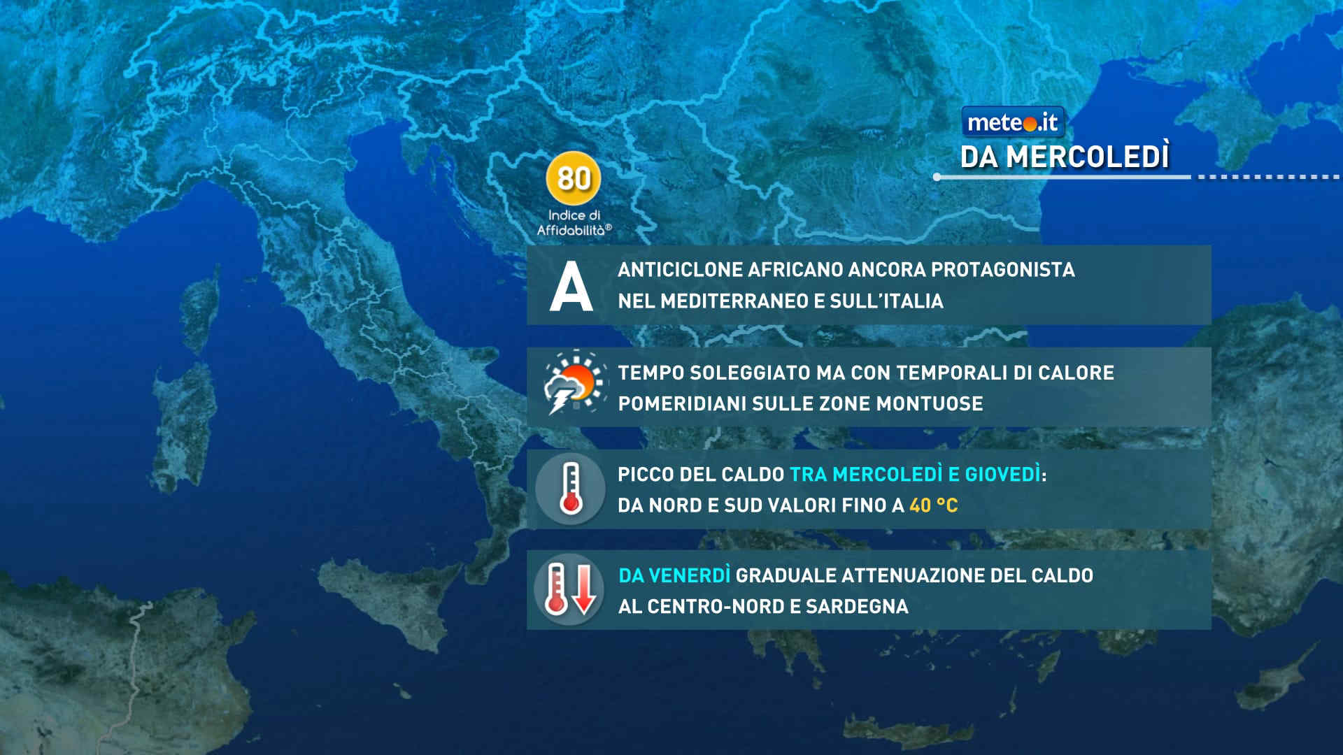
La calura con dà tregua: le temperature elevate saranno ancora una costante con tutti i disagi conseguenti per l’organismo e l’ambiente. Afa e notti tropicali
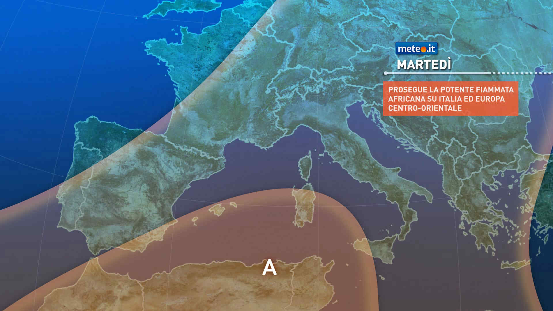
Meteo, il caldo opprimente proseguirà anche la prossima settimana
La situazione rimarrà critica sul fronte della siccità, rischio incendi e sofferenza per i ghiacciai con lo zero termico ben oltre 4500 metri. Afa e notti tropicali


 0
0 56%
56% 6-16 Km/h
 Nord
Nord Nord NE
 Nord E
 Est
Est Est SE
 74%
74% Sud SE
 Sud
Sud Sud SO
 Ovest SO
 6
6 Ovest
Ovest Ovest NO
 Ovest NO
 Nord O
 Nord NO