FacebookInstagramXWhatsApp

Meteo Cotignola tra 4 giorni. Previsioni del tempo, precipitazioni, temperatura e venti

FacebookWhatsappXTelegram

Cotignola
07:06
18:58
Gibbosa calante
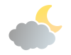
Notte
sereno notte
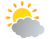
Mattino
cielo in gran parte nuvoloso
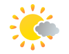
Pomeriggio
soleggiato
Sera
sereno notte
  • 17°

    UV Normale 0

    ore

    sereno notte

    Umidità alta79%

    Raffiche normali5-13 Km/h

    SudSud

  • 17°

    UV Normale 0

    ore

    sereno notte

    Umidità alta81%

    Raffiche normali4-11 Km/h

    SudSud

  • 16°

    UV Normale 0

    ore

    sereno notte

    Umidità alta82%

    Raffiche normali3-8 Km/h

    Sud sud ovestSud SO

  • 15°

    UV Normale 0

    ore

    sereno notte

    Umidità alta84%

    Raffiche normali3-6 Km/h

    Sud ovestSud O

  • 14°

    UV Normale 0

    ore

    sereno notte

    Umidità alta85%

    Raffiche normali3-6 Km/h

    Ovest sud ovestOvest SO

  • 14°

    UV Normale 0

    ore

    sereno notte

    Umidità alta86%

    Raffiche normali3-7 Km/h

    Ovest sud ovestOvest SO

  • 14°

    UV Normale 0

    ore

    sereno notte

    Umidità alta88%

    Raffiche normali3-7 Km/h

    Ovest sud ovestOvest SO

  • 14°

    UV Normale 1

    ore

    prevalentemente soleggiato

    Umidità alta89%

    Raffiche normali3-7 Km/h

    Ovest sud ovestOvest SO

  • 14°

    UV Normale 2

    ore

    prevalentemente soleggiato

    Umidità alta91%

    Raffiche normali3-8 Km/h

    OvestOvest

  • 14°

    UV Normale 3

    ore

    cielo in gran parte nuvoloso

    Umidità alta92%

    Raffiche normali4-8 Km/h

    OvestOvest

  • 16°

    UV Normale 4

    ore

    cielo in gran parte nuvoloso

    Umidità alta85%

    Raffiche normali4-9 Km/h

    Ovest nord ovestOvest NO

  • 18°

    UV Normale 5

    ore

    cielo in gran parte nuvoloso

    Umidità alta77%

    Raffiche normali5-11 Km/h

    Ovest nord ovestOvest NO

  • 20°

    UV Elevato 6

    ore

    cielo in gran parte nuvoloso

    Umidità normale70%

    Raffiche normali5-12 Km/h

    Nord ovestNord O

  • 21°

    UV Elevato 7

    ore

    prevalentemente soleggiato

    Umidità normale63%

    Raffiche normali6-13 Km/h

    Nord nord ovestNord NO

  • 23°

    UV Elevato 6

    ore

    prevalentemente soleggiato

    Umidità normale56%

    Raffiche normali6-14 Km/h

    NordNord

  • 25°

    UV Normale 5

    ore

    soleggiato

    Umidità normale48%

    Raffiche normali7-16 Km/h

    Nord nord estNord NE

  • 27°

    UV Normale 3

    ore

    soleggiato

    Umidità normale41%

    Raffiche normali7-16 Km/h

    Nord nord estNord NE

  • 26°

    UV Normale 2

    ore

    soleggiato

    Umidità normale48%

    Raffiche normali7-17 Km/h

    Nord estNord E

  • 25°

    UV Normale 1

    ore

    soleggiato

    Umidità normale55%

    Raffiche normali7-17 Km/h

    Est nord estEst NE

  • 23°

    UV Normale 0

    ore

    sereno notte

    Umidità normale61%

    Raffiche normali7-18 Km/h

    EstEst

  • 22°

    UV Normale 0

    ore

    sereno notte

    Umidità normale68%

    Raffiche normali7-19 Km/h

    EstEst

  • 21°

    UV Normale 0

    ore

    sereno notte

    Umidità alta75%

    Raffiche forti7-19 Km/h

    Est sud est intensoEst SE

  • 21°

    UV Normale 0

    ore

    sereno notte

    Umidità alta76%

    Raffiche normali7-17 Km/h

    Sud estSud E

  • 20°

    UV Normale 0

    ore

    sereno notte

    Umidità alta76%

    Raffiche normali6-15 Km/h

    Sud sud estSud SE

  • 19°

    UV Normale 0

    ore

    sereno notte

    Umidità alta77%

    Raffiche normali5-13 Km/h

    SudSud

Meteo provincia di Ravenna
Meteo Nord-Est Italia
Oggi

Al mattino cielo sereno o poco nuvoloso, ma con maggiore nuvolosita' in Friuli Venezia Giulia. Temperature minime in lieve calo. Nel pomeriggio cielo da poco nuvoloso a parzialmente nuvoloso; nubi piu' compatte sulle Alpi. In serata qualche rovescio in Friuli Venezia Giulia. Temperature massime in rialzo. Venti deboli. Mare Adriatico poco mosso.

Ultime newsVedi tutte


Meteo, alta pressione in rinforzo e temperature estive: la tendenza
Tendenza24 Settembre 2026
Meteo, alta pressione in rinforzo e temperature estive: la tendenza
Il mese di settembre si chiuderà con temperature sopra la norma e valori estivi: attesi picchi attorno ai 30 gradi al Centro-nord. La tendenza meteo
Meteo, primo weekend d'autunno con alta pressione e rialzo termico
Tendenza23 Settembre 2026
Meteo, primo weekend d'autunno con alta pressione e rialzo termico
Tempo in generale stabile nel weekend del 26-27 settembre con rovesci residui sabato all'estremo Sud. Fine settembre estivo con 30 gradi. La tendenza meteo
Meteo, veloce perturbazione da giovedì sera. Nel weekend torna l'alta pressione con temperature in rialzo
Tendenza22 Settembre 2026
Meteo, veloce perturbazione da giovedì sera. Nel weekend torna l'alta pressione con temperature in rialzo
Veloce perturbazione tra giovedì e venerdì. Nel weekend torna l'alta pressione con tempo stabile e temperature nuovamente in aumento
Mediaset

Ultimo aggiornamento Giovedì 24 Settembre ore 14:43

Copyright © 1999-2020 RTI S.p.A. Direzione Business Digital - P.Iva 03976881007 - Tutti i diritti riservati.

Rispetto ai contenuti e ai dati personali trasmessi e/o riprodotti è vietata ogni utilizzazione funzionale all'addestramento di sistemi di intelligenza artificiale generativa. È altresì fatto divieto espresso di utilizzare mezzi automatizzati di data scraping.

Per la pubblicità Mediamond S.p.a. RTI spa, Gruppo Mediaset - Sede legale: 00187 Roma Largo del Nazareno 8 - Cap. Soc. € 500.000.007,00 int. vers. - Registro delle Imprese di Roma, C.F.06921720154