Al mattino sulle regioni adriatiche nuvolosita' variabile, con le ultime sporadiche e deboli piogge lungo le coste tra Abruzzo e Molise. Cielo sereno sulle altre regioni. Temperature minime in diminuzione. Nel pomeriggio nuvolosita' residua su Abruzzo e Molise, ma con basso rischio di eventuali fenomeni di poco conto. Per il resto tempo soleggiato. Temperature massime in diminuzione, piu' sensibile sul versante adriatico dove si restera' sotto i 30 gradi. Venti: settentrionali in temporaneo rinforzo, fino a localmente tesi. Mari mossi.
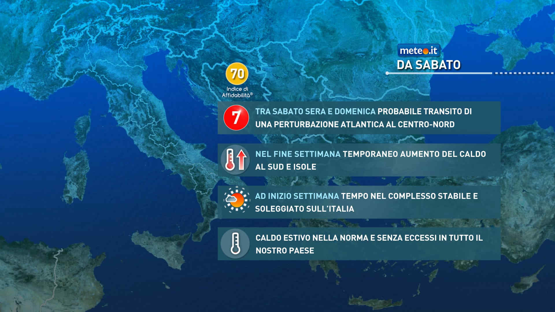
Meteo, nel weekend del 25-26 luglio perturbazione in transito. Stop alla calura
Correnti più fresche di origine nord atlantica riporteranno le temperature su valori prossimi alla norma in tutta la penisola. Perturbazione n.7 in vista


 0
0 78%
78% 21-35 Km/h
 Sud SE
 Sud
Sud 6
6 Sud SO
 70%
70% Ovest SO
 Ovest
Ovest Nord O
 Nord NO