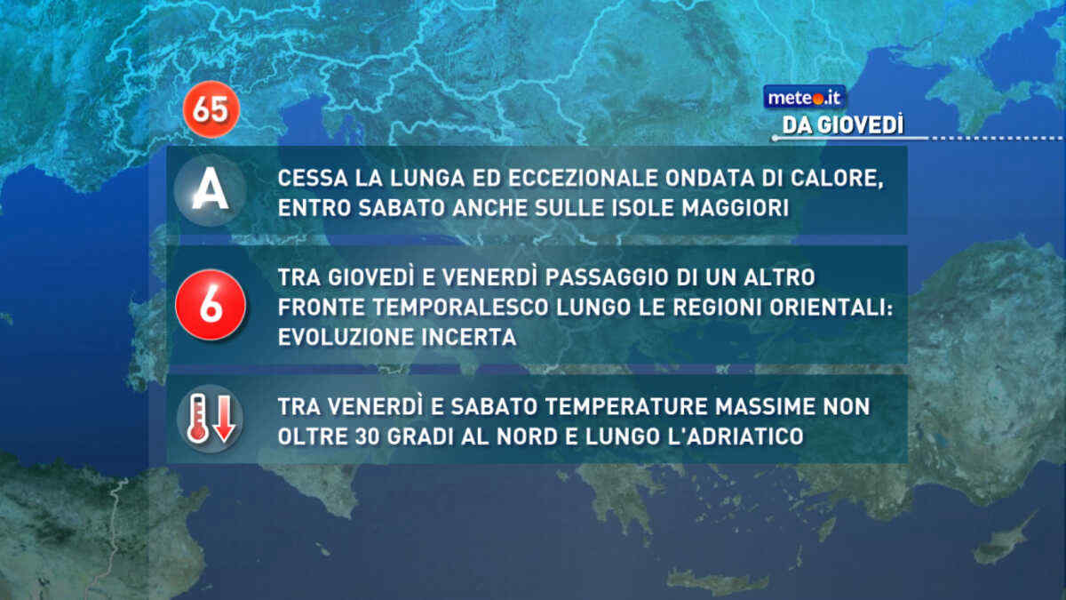
Al mattino sereno o poco nuvoloso in Emilia Romagna; nuvolosita' sparsa nelle altre regioni. Temperature minime in lieve diminuzione. Nel pomeriggio instabilita' in aumento su Alpi, Prealpi e Appennino, con isolati rovesci o temporali. Temperature massime tra 27 e 31 gradi. Venti per lo piu' deboli. Mare Adriatico poco mosso.
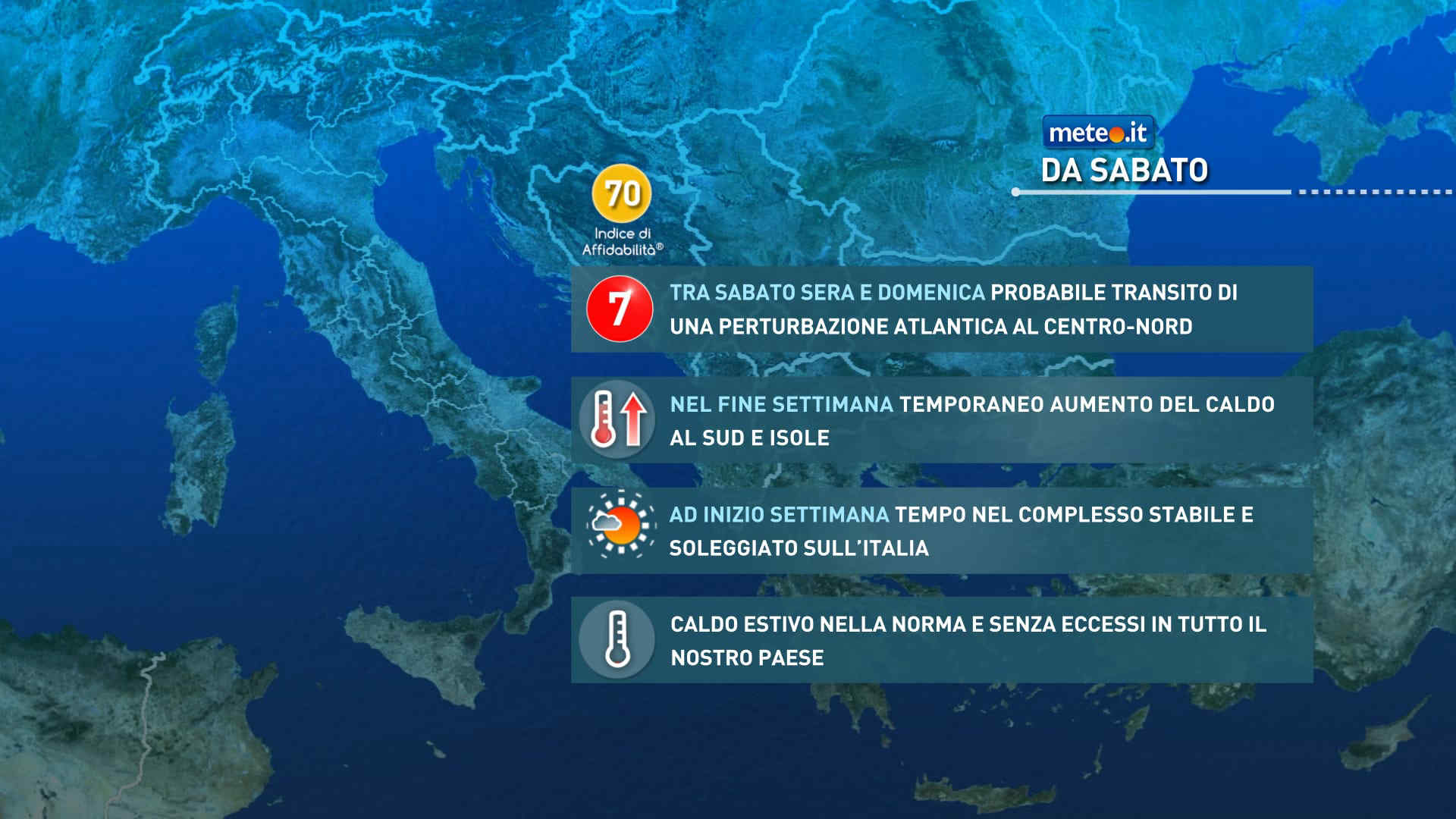
Meteo, ad inizio settimana tempo soleggiato e caldo nella norma
Ci sono le premesse per una nuova ondata di calore tra fine luglio e i primi di agosto: le temperature dovrebbero tornare oltre media con anomalie più marcate al Centro-Nord
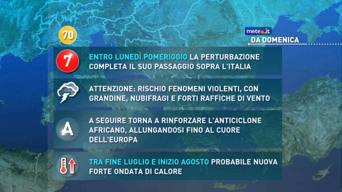
Meteo, nel weekend del 25-26 luglio perturbazione in transito. Stop alla calura
Correnti più fresche di origine nord atlantica riporteranno le temperature su valori prossimi alla norma in tutta la penisola. Perturbazione n.7 in vista


 0
0
 62%
62% 11-22 Km/h
 Nord E
 Nord E
 Nord NE
 6
6 Nord
Nord Nord NO
 Ovest NO
 Ovest
Ovest Ovest SO
 Sud SO
 Sud O
Sud O Nord O