MeteoSan MarinoMeteo San Marino tra 10 giorni. Previsioni del tempo, precipitazioni, temperatura e venti Ma 14 lug Me 15 lug Gi 16 lug Vento al pomeriggio ed alla seraNotteMattinoPomeriggioSera27° 0ore0038%13-19 Km/hSud SE27° 0ore0139%11-18 Km/hSud SE26° 0ore0239%10-17 Km/hSud26° 0ore0339%9-15 Km/hSud SO25° 0ore0439%9-16 Km/hSud O25° 1ore0539%9-17 Km/hOvest SO26° 2ore0639%9-18 Km/hOvest27° 3ore0738%9-19 Km/hOvest NO28° 4ore0838%9-20 Km/hNord O29° 6ore0937%9-20 Km/hNord30° 7ore1036%11-22 Km/hNord NE31° 8ore1135%13-23 Km/hNord NE32° 9ore1234%16-25 Km/hNord E32° 10ore1333%18-26 Km/hNord E33° 9ore1432%21-28 Km/hNord E34° 7ore1531%23-29 Km/hEst NE35° 6ore1630%22-30 Km/hEst NE34° 5ore1730%22-31 Km/hEst33° 4ore1829%21-32 Km/hEst33° 2ore1929%20-33 Km/hEst32° 1ore2028%19-34 Km/hEst SE31° 0ore2128%18-35 Km/hEst SE30° 0ore2233%19-35 Km/hEst SE29° 0ore2338%19-35 Km/hSud E20° 0ore0069%21-34 Km/hSud SE
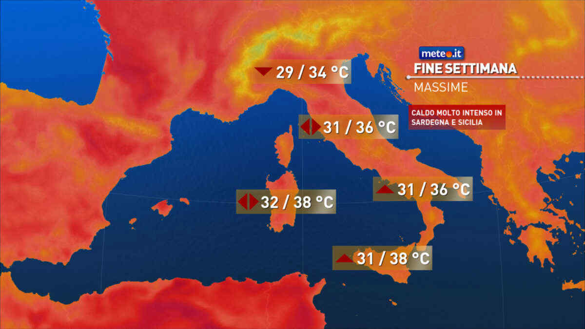
Tendenza8 Luglio 2026Meteo: nel weekend caldo nella norma al Nord, roventi le Isole!La tendenza meteo per il weekend indica un caldo intenso al Centro-Sud e soprattutto nelle Isole mentre al Nord sarà attenutato dai temporali.
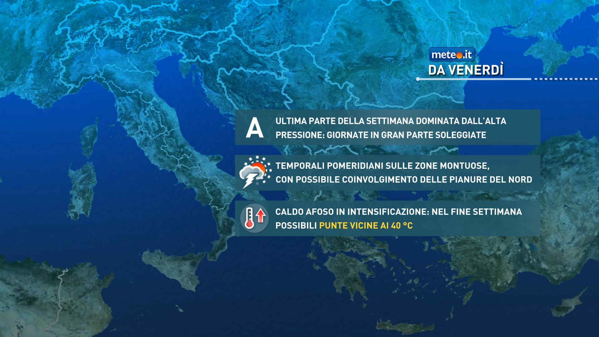
Tendenza7 Luglio 2026Meteo, dal 10 luglio temperature verso picchi di 40 gradi: la tendenzaCaldo e afa in ulteriore aumento tra il weekend e la prima parte della prossima settimana: sulle Isole i valori più elevati. Temporali di calore sui rilievi. La tendenza meteo
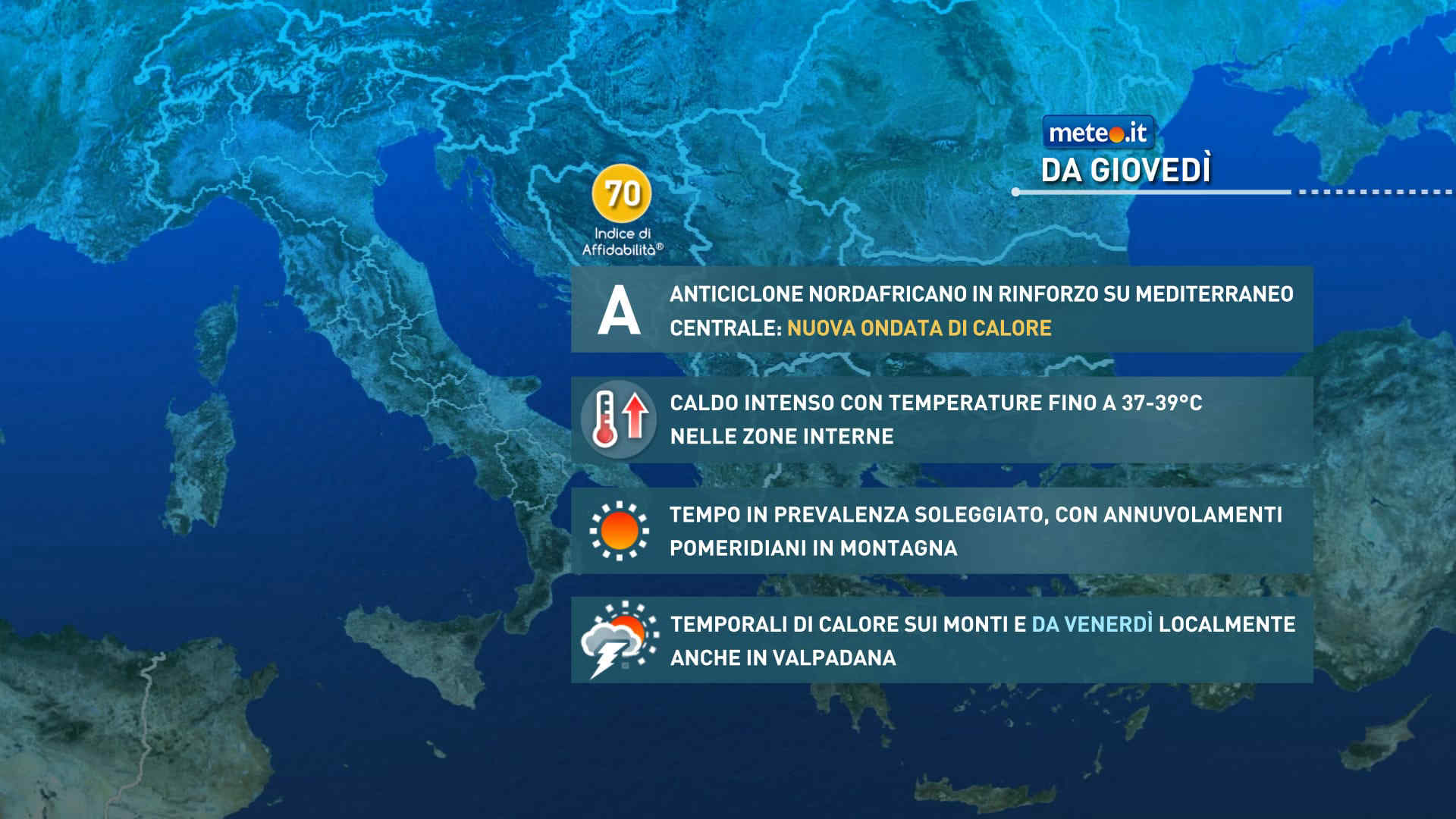
Tendenza6 Luglio 2026Meteo, torna l'Anticiclone nord-africano: ondata di calore in vistaCaldo in intensificazione sull'Italia: picchi di 37-39 gradi e umidità in aumento. Qualche temporale di calore. La tendenza meteo dal 9 luglio


 0
0 38%
38% 13-19 Km/h
 Sud SE
 Sud SE
 Sud
Sud Sud SO
 Sud O
Sud O Ovest SO
 Ovest
Ovest Ovest NO
 Nord O
 6
6 Nord
Nord Nord NE
 Nord E
 Est NE
 Est
Est Est SE
 Sud E
Sud E