Al mattino cielo sereno su tutta la regione. Temperature minime in aumento. Nel pomeriggio tempo generalmente soleggiato e caldo, con pochi modesti annuvolamenti nelle aree interne. Temperature massime in lieve aumento e fino a punte di 32-33 gradi. Venti deboli, salvo temporanei rinforzi di brezza specie lungo i litorali. Mari in prevalenza poco mossi.
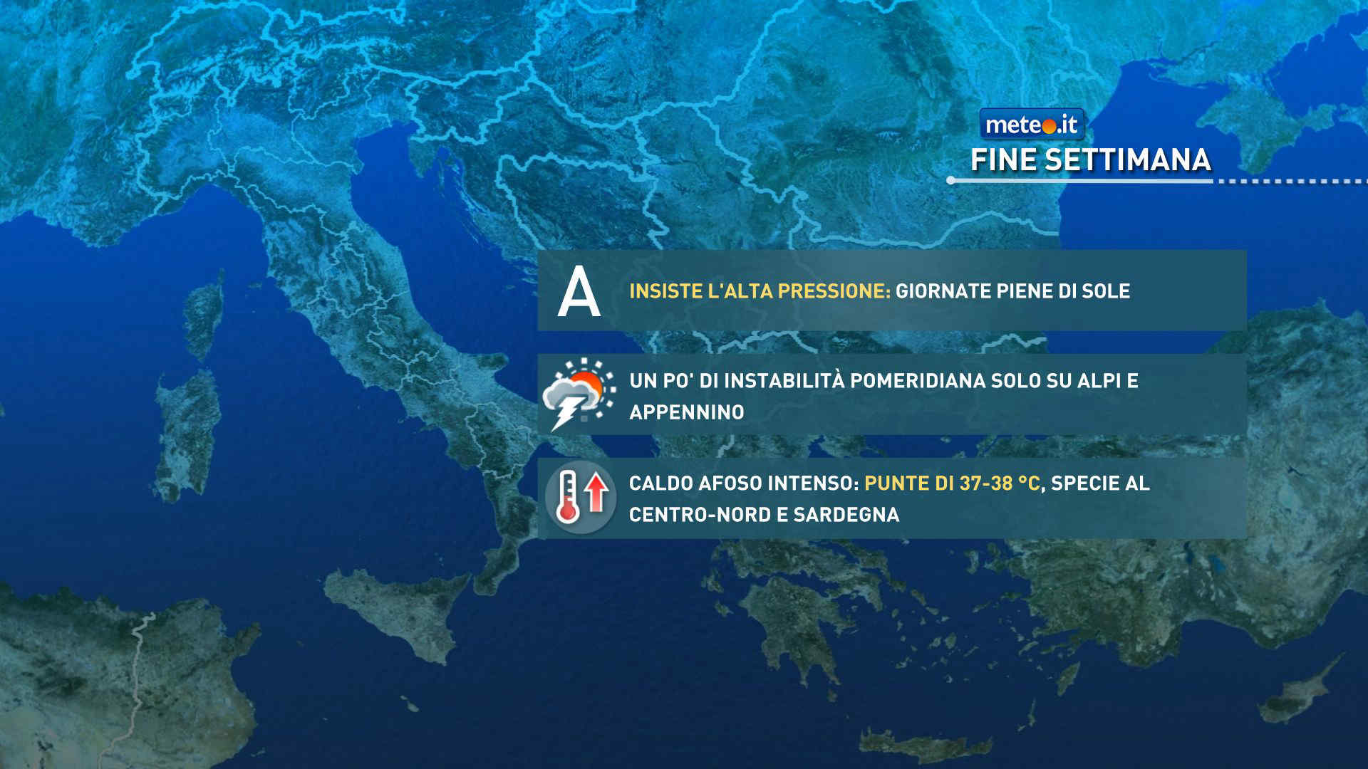
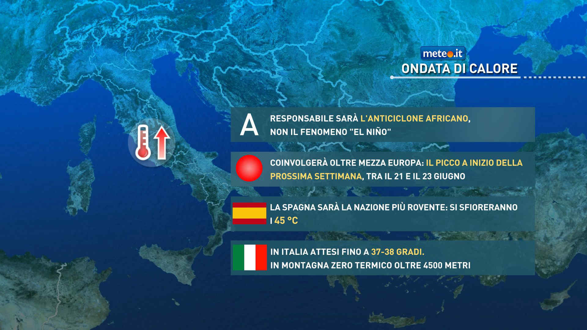
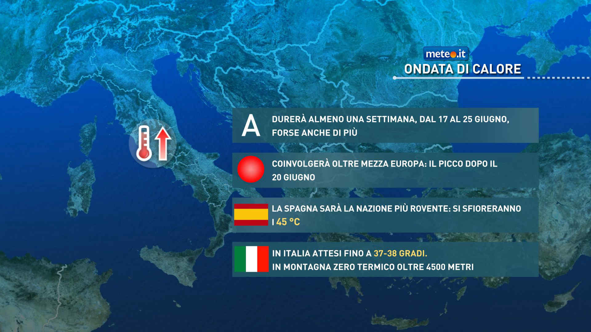
Secondo i dati attuali l'ondata di caldo potrebbe essere eccezionale per durata, estensione e intensità. La calura si farà più intensa nel fine settimana


 0
0 60%
60% 10-18 Km/h
 Nord O
 7
7 Nord E
 Sud E
Sud E Ovest SO
 Nord O