Al mattino cielo in prevalenza sereno. Temperature minime in lieve diminuzione. Nel pomeriggio tempo generalmente soleggiato, con un po' di nubi ad alta quota in arrivo da ovest. Temperature massime in aumento, soprattutto su aree interne e regioni adriatiche. Venti: moderati di scirocco lungo la fascia tirrenica; per lo piu' deboli altrove. Mari: mosso il Tirreno, calmo o poco mosso l'Adriatico.
Meteo, dal 27-28 luglio caldo in intensificazione: la tendenza
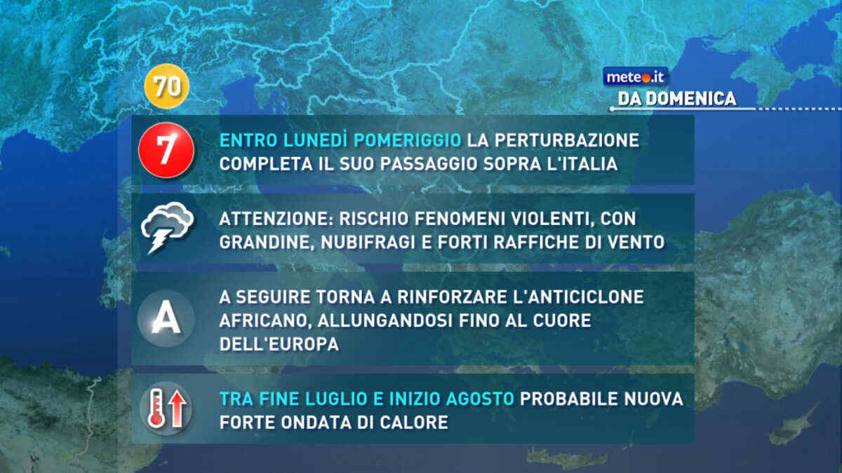
L'evoluzione meteo indica un progressivo rinforzo dell’anticiclone africano ed il probabile avvio di una nuova forte ondata di caldo. La tendenza dal 27 luglio
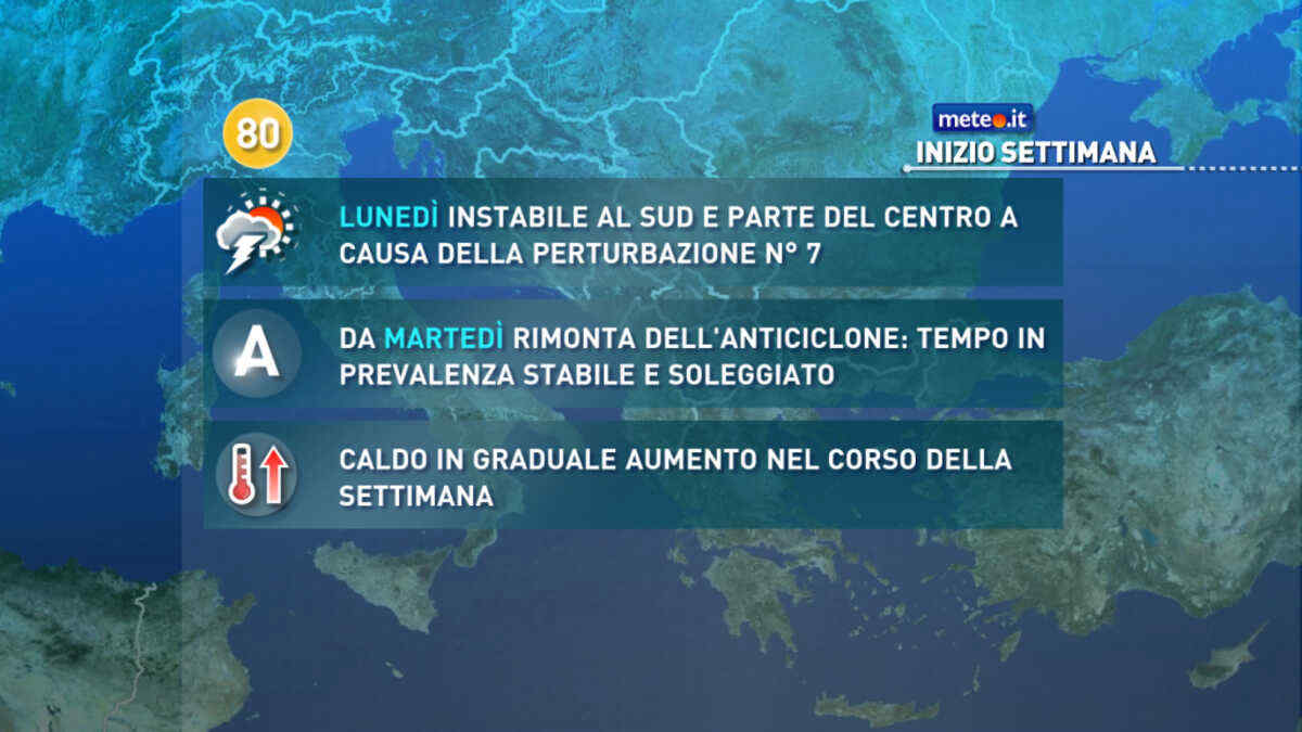
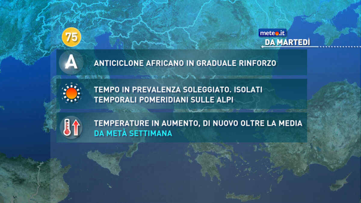
Meteo, ad inizio settimana tempo soleggiato e caldo nella norma
Ci sono le premesse per una nuova ondata di calore tra fine luglio e i primi di agosto: le temperature dovrebbero tornare oltre media con anomalie più marcate al Centro-Nord


 0
0
 57%
57% 7-14 Km/h
 Ovest SO
 Ovest
Ovest Sud O
Sud O Sud SO
 72%
72% 6
6 Sud
Sud Sud SE
 Sud E
Sud E Est SE
 Est
Est Est NE
 Nord E
 Nord NE
 Nord
Nord Nord O
 Ovest NO
 Ovest SO