Al mattino tempo prevalentemente soleggiato. Temperature minime in leggero calo. Nel pomeriggio cielo sereno o poco nuvoloso. Possibilita' di rovesci o temporali isolati sulle Prealpi orientali lombarde. Temperature massime in lieve diminuzione. Venti: generalmente deboli; libeccio in intensificazione sul mar Ligure. Mar Ligure da poco mosso a mosso.
Meteo, stop all'ondata di caldo: aria più fresca in arrivo, ecco quando
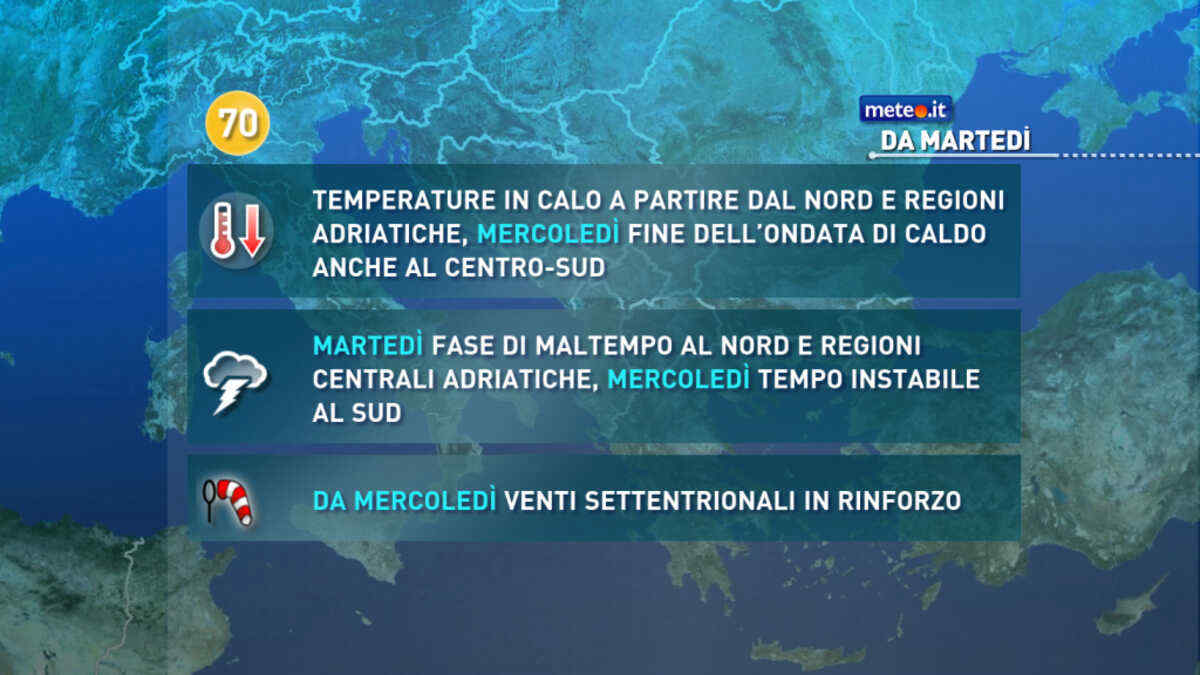
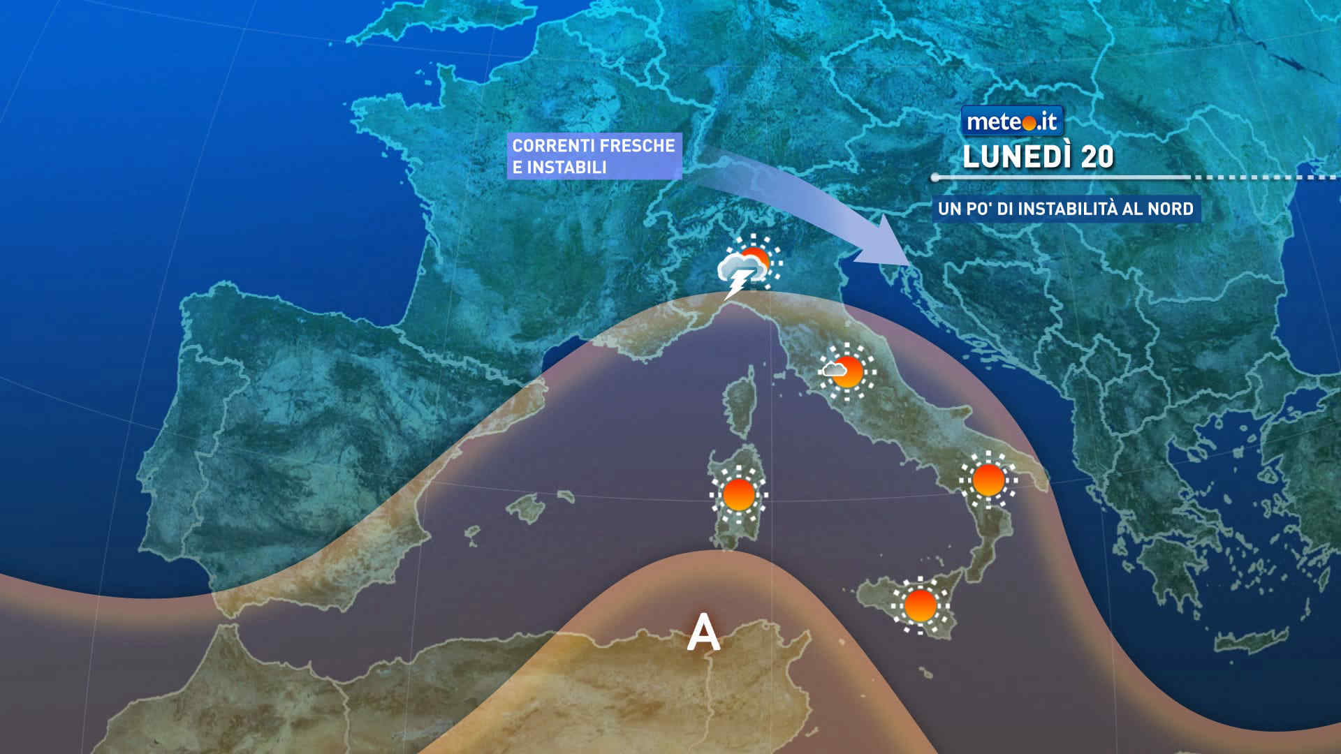
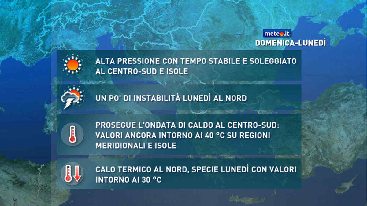
Calo delle temperature a partire da lunedì 20 luglio al Nord ed entro giovedì anche al Sud. Venti settentrionali più freschi spazzeranno via l'afa. La tendenza meteo


 0
0 40%
40% 12-23 Km/h
 Est NE
 Est
Est Est SE
 Sud E
Sud E Sud E
Sud E 6
6 Sud SE
 Sud
Sud Sud SO
 Sud SE