Al mattino nuvolosita' irregolare con temporali sparsi in Calabria e qualche fenomeno piu' isolato su bassa Campania, Foggiano, Potentino e Murge. Temperature minime in calo. Nel pomeriggio ancora tempo instabile con rischio di locali rovesci o temporali su Calabria, Campania e Lucania, piu' soleggiato lungo le coste adriatiche della Puglia. La sera residui fenomeni solo sulla Calabria tirrenica. Temperature massime in calo in Calabria, senza grosse variazioni altrove; valori per lo piu' sotto i 30-32 gradi. Venti settentrionali fino a moderati su Puglia, Appennino e alto Ionio; raffiche nelle aree temporalesche. Mari mossi o localmente poco mossi.
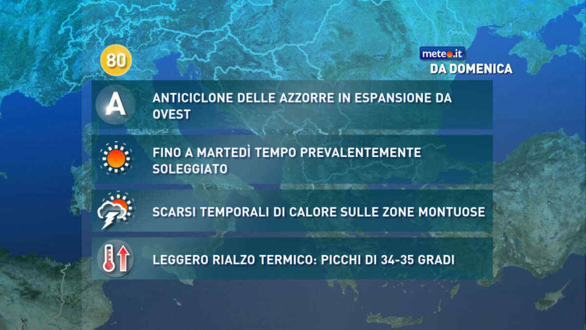
Meteo, dal 5 luglio alta pressione in rinforzo: caldo ma senza picchi estremi
Si rafforza l'Anticiclone delle Azzorre: tempo soleggiato e caldo ma senza picchi estremi. Pochi temporali di calore sui rilievi. La tendenza meteo dal 5 luglio
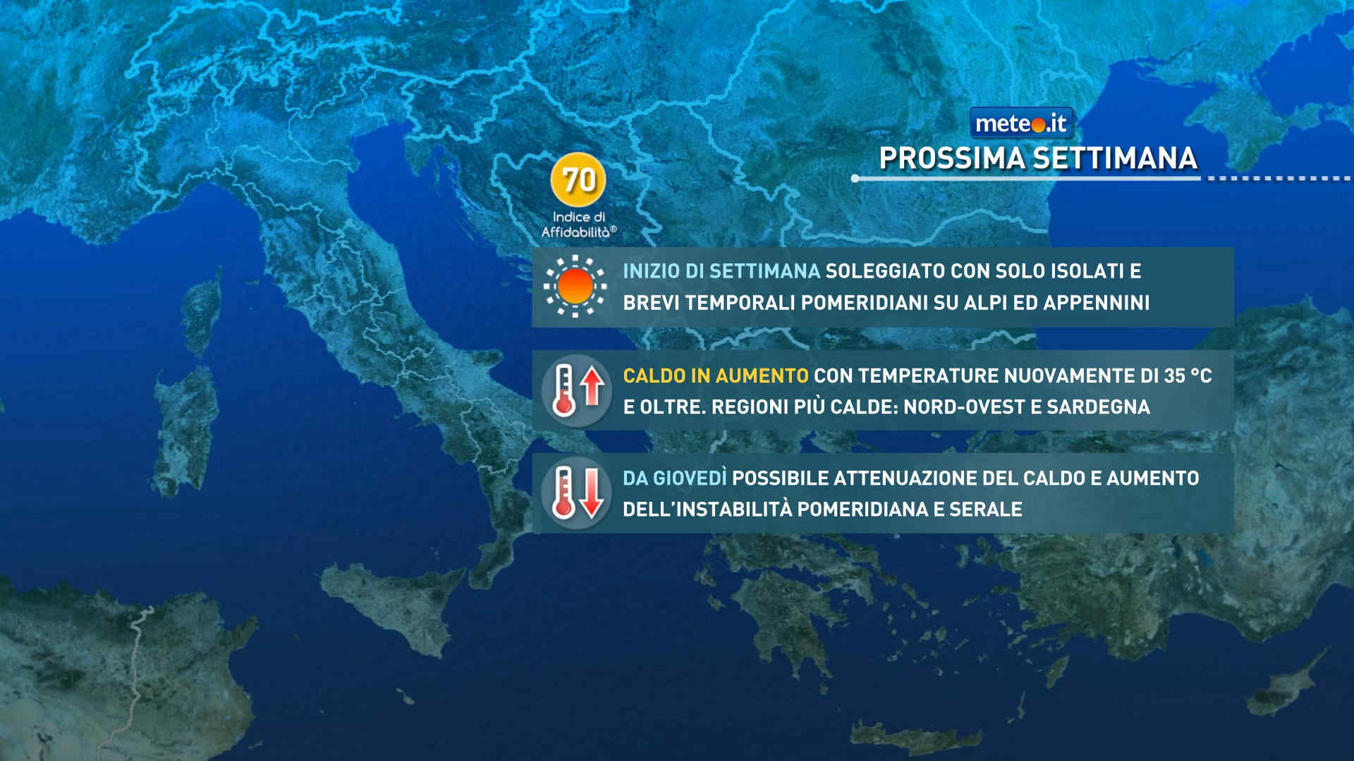
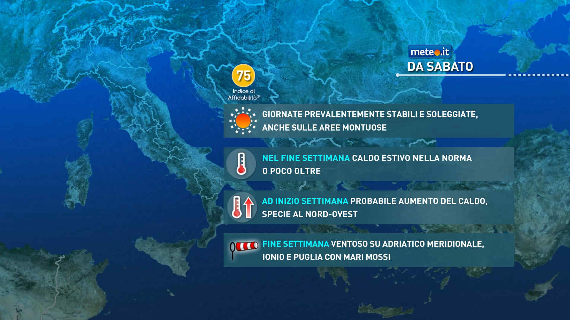
Meteo, nel weekend del 4-5 luglio caldo più sopportabile
Fino a domenica le temperature resteranno più sopportabili quasi ovunque. Probabile un nuovo rialzo delle temperature durante i primi giorni della prossima settimana


 0
0 54%
54% 4-9 Km/h
 Sud E
Sud E Est SE
 Est
Est Est NE
 Nord E
 Nord
Nord Nord NO
 6
6 Nord O
 Ovest NO
 Ovest NO
 Ovest
Ovest Ovest SO
 Sud O
Sud O Sud SO
 Sud
Sud Sud SE