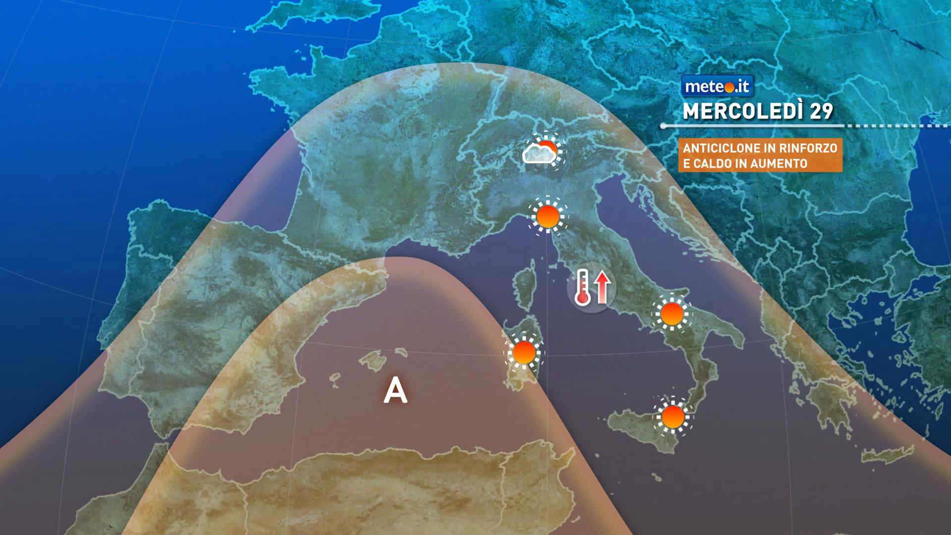
Al mattino locali addensamenti nelle Prealpi lombarde e nei rilievi dell'alto Piemonte, cielo sereno o poco nuvoloso altrove. Temperature minime in rialzo. Nel pomeriggio tempo in prevalenza soleggiato. Un po' di nuvole sparse solo sui rilievi lombardi e piemontesi con la possibilita' di sporadici e brevi rovesci in quelli del Torinese e del Cuneese. Temperature massime in ulteriore lieve aumento con punte fino ai 32-33 gradi. Venti deboli. Mar Ligure poco mosso.
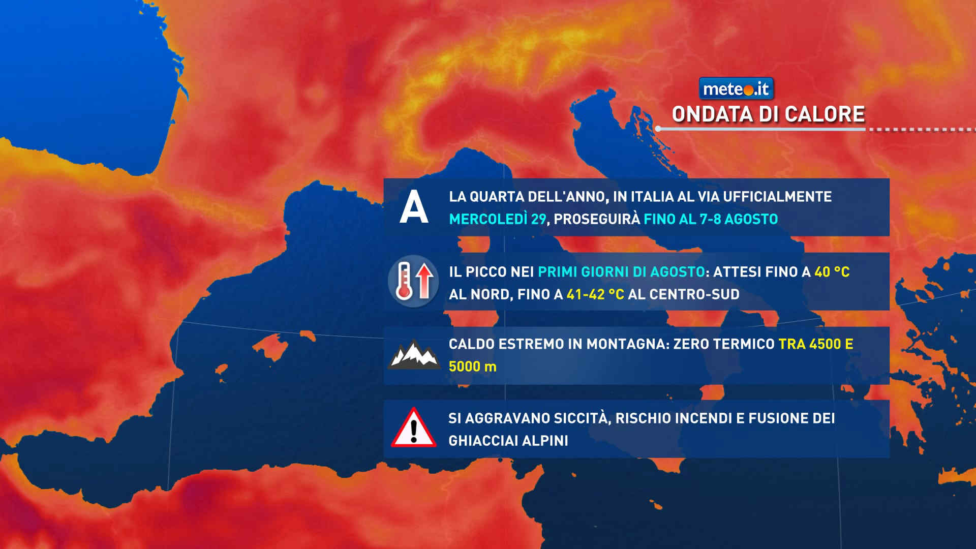
Meteo, quarta ondata di caldo intenso: di nuovo verso i 40 gradi
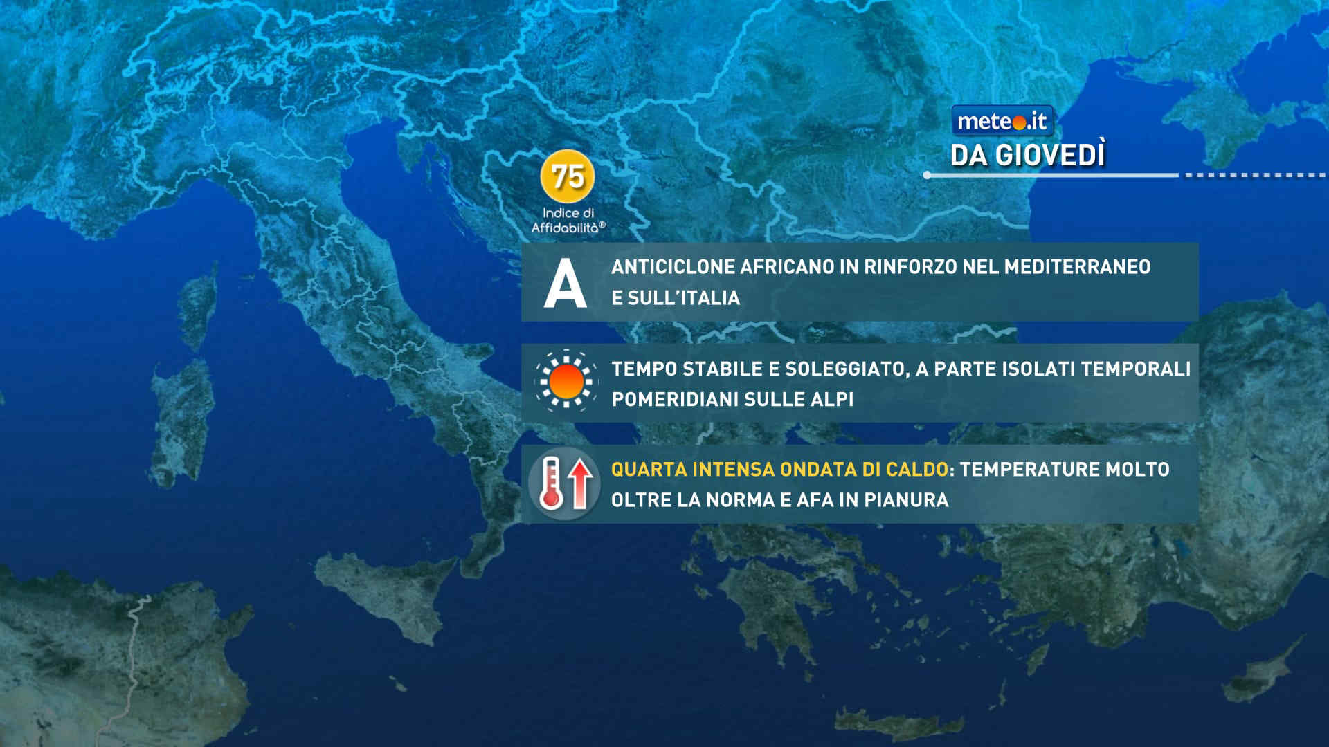
Anticiclone nord-africano protagonista sull'Europa centro-occidentale e sull'Italia da metà settimana: caldo e afa in forte aumento. La tendenza meteo dal 29 luglio


 0
0 48%
48% 7-17 Km/h
 Nord E
 Nord NE
 Est NE
 6
6 Est SE
 Sud E
Sud E Sud
Sud Sud SO
 Ovest SO
 Ovest
Ovest Nord O
 Ovest NO