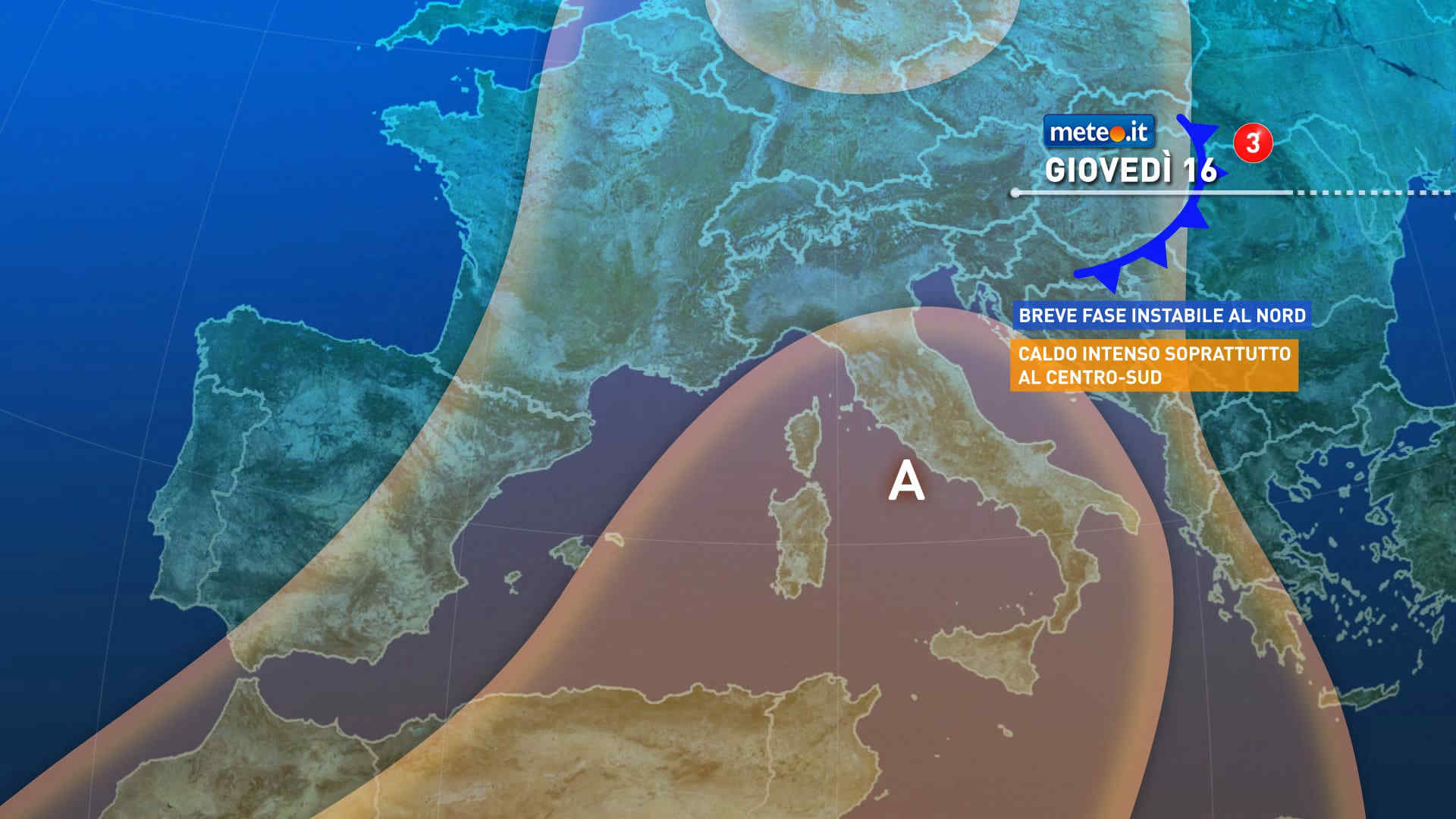
Al mattino cielo sereno o velato in Liguria. Un po' piu' di nubi in transito nelle altre regioni, specie sui settori alpini tra alto Piemonte e Lombardia dove saranno anche possibili dei locali rovesci o temporali. Temperature minime in lieve crescita. Nel pomeriggio nubi sparse sulle aree alpine con sviluppo di temporali sui settori tra l'alto Pimonte e la Lombardia. Sereno o velato altrove. In serata ampi rasserenamenti Temperature massime in lieve aumento con valori fino a 35-36 gradi. Venti deboli a regime di brezza. Mar Ligure calmo o poco mosso.
Meteo, ondata di caldo a oltranza: la tendenza dal 15 luglio
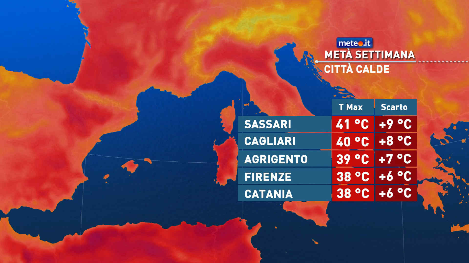
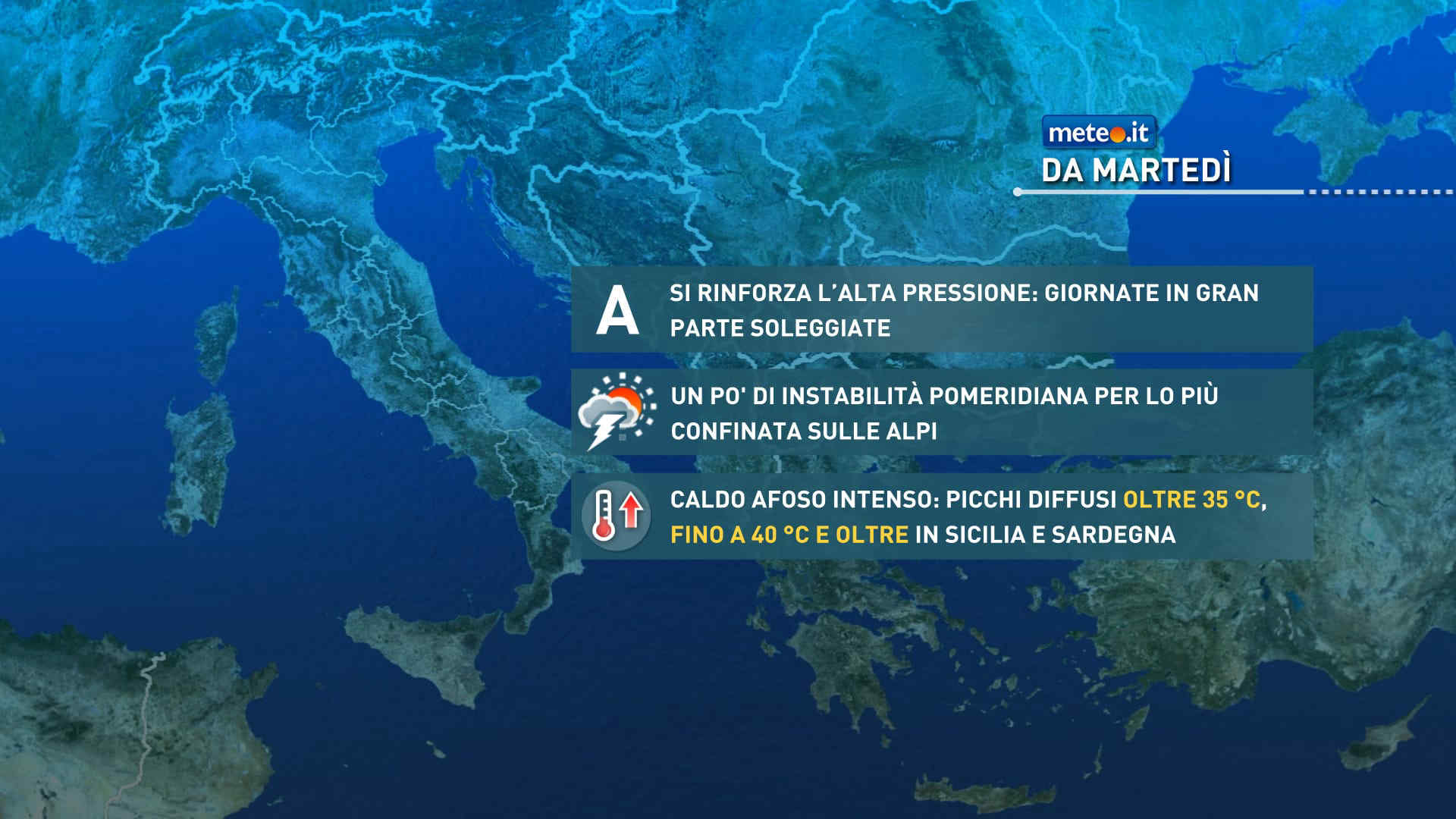
L'ondata di caldo in atto tenderà ad intensificarsi da metà settimana con valori oltre i 40 gradi. Zero termico a 5000 metri di quota. La tendenza meteo


 0
0 52%
52% 6-15 Km/h
 Ovest SO
 Ovest
Ovest Ovest NO
 Nord O
 6
6 Nord NO
 Nord
Nord Nord NE
 Nord E
 Est NE
 Est SE
 Est
Est