Al mattino tempo soleggiato con tendenza a qualche annuvolamento a ridosso dei monti. Temperature minime in lieve aumento. Nel pomeriggio tempo in prevalenza soleggiato sulla pianura centrale e nelle riviere liguri. Altrove nuvolosita' in aumento, di tipo cumuliforme in montagna con possibili isolati rovesci e temporali, piu' probabili sui rilievi piemontesi e nelle Orobie. Temperature massime stabili o in ulteriore lieve aumento, su valori elevati, ad 34 a 37 gradi. Venti deboli. Mar Ligure calmo o poco mosso.
Meteo, ondata di caldo africano fino alla fine del mese: la tendenza
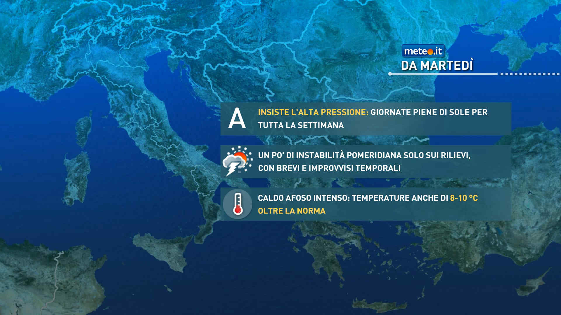
L'ondata di caldo africano in atto sarà particolarmente lunga: durerà almeno fino alla fine del mese e probabilmente fino a inizio luglio con temperature sopra la norma di 10 gradi. La tendenza meteo
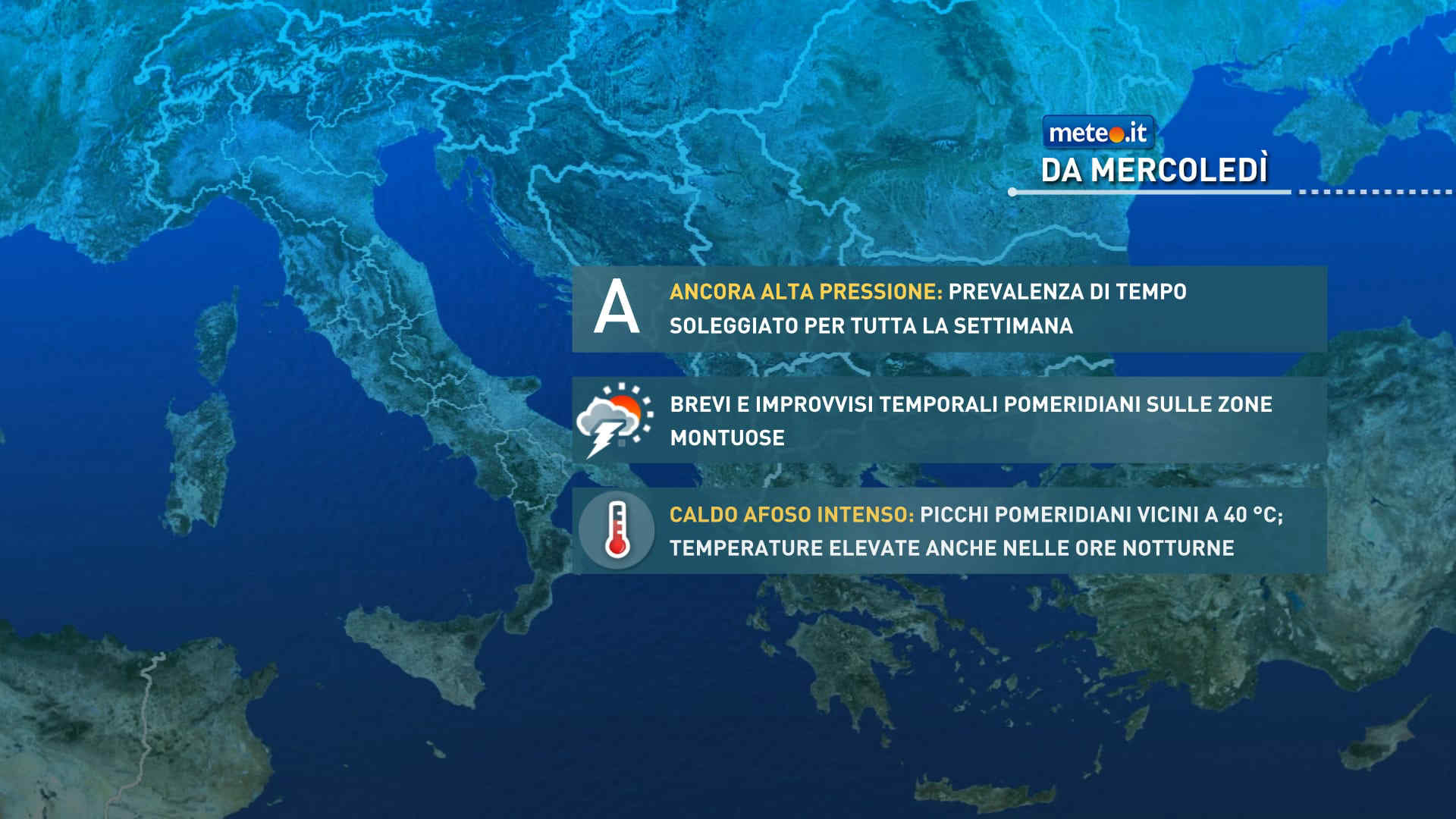
Meteo, ondata di caldo a oltranza: anche la prossima settimana Anticiclone nord-africano
L'ondata di caldo intenso proseguirà anche per tutta la prossima settimana e probabilmente fino alla fine del mese di giugno. La tendenza meteo dal 23 giugno


 0
0 41%
41% 6-15 Km/h
 Est SE
 Est
Est 6
6 Est NE
 Nord E
 Nord NE
 Nord NE
 Nord NO
 Nord O
 Ovest NO