Al mattino schiarite anche ampie in Campania, nuvolosita' irregolare e variabile altrove con la possibilita' di locali rovesci in Puglia e Calabria. Temperature minime in calo di 1-3 gradi. Nel pomeriggio tendenza ad ampie schiarite anche su Lucania e Puglia con qualche iniziale pioggia isolata nel Salento in esaurimento. Nuvole piu' insistenti in Calabria con residui brevi rovesci o temporali e successive schiarite in serata. Temperature massime in ulteriore diminuzione e comprese tra 26 e 32 con il caldo ormai del tutto smorzato anche per effetto di moderati o localmente tesi venti settentrionali. Mari per lo piu' mossi o localmente poco mossi sotto costa nel versante tirrenico e nel golfo di Taranto.
Meteo, dal 27-28 luglio caldo in intensificazione: la tendenza
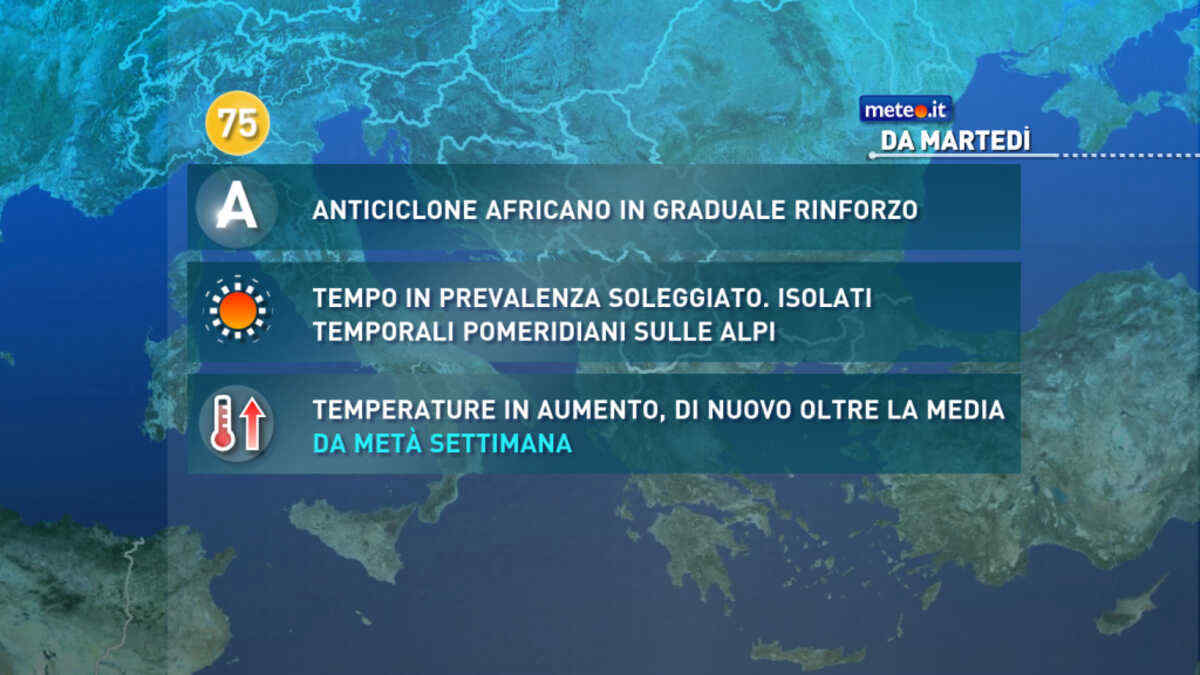
L'evoluzione meteo indica un progressivo rinforzo dell’anticiclone africano ed il probabile avvio di una nuova forte ondata di caldo. La tendenza dal 27 luglio
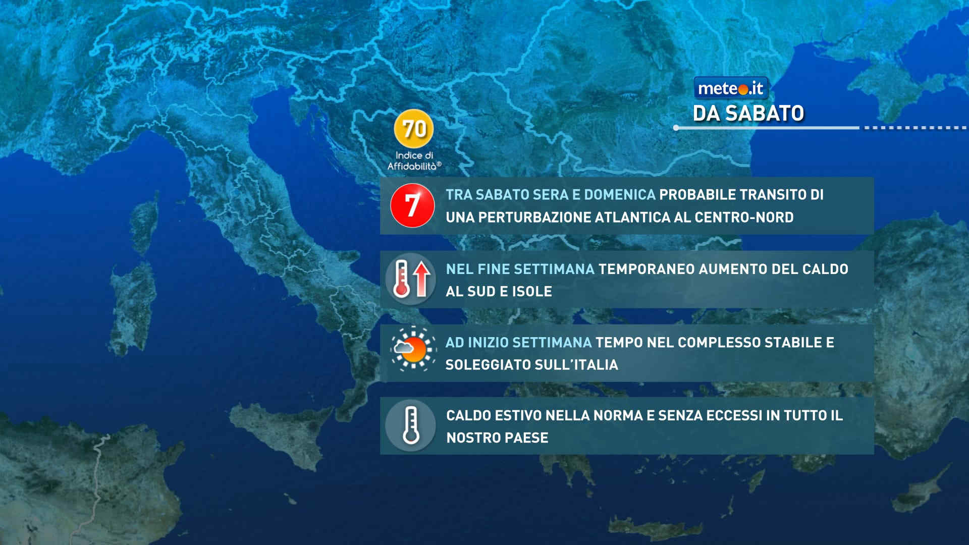
Meteo, ad inizio settimana tempo soleggiato e caldo nella norma
Ci sono le premesse per una nuova ondata di calore tra fine luglio e i primi di agosto: le temperature dovrebbero tornare oltre media con anomalie più marcate al Centro-Nord
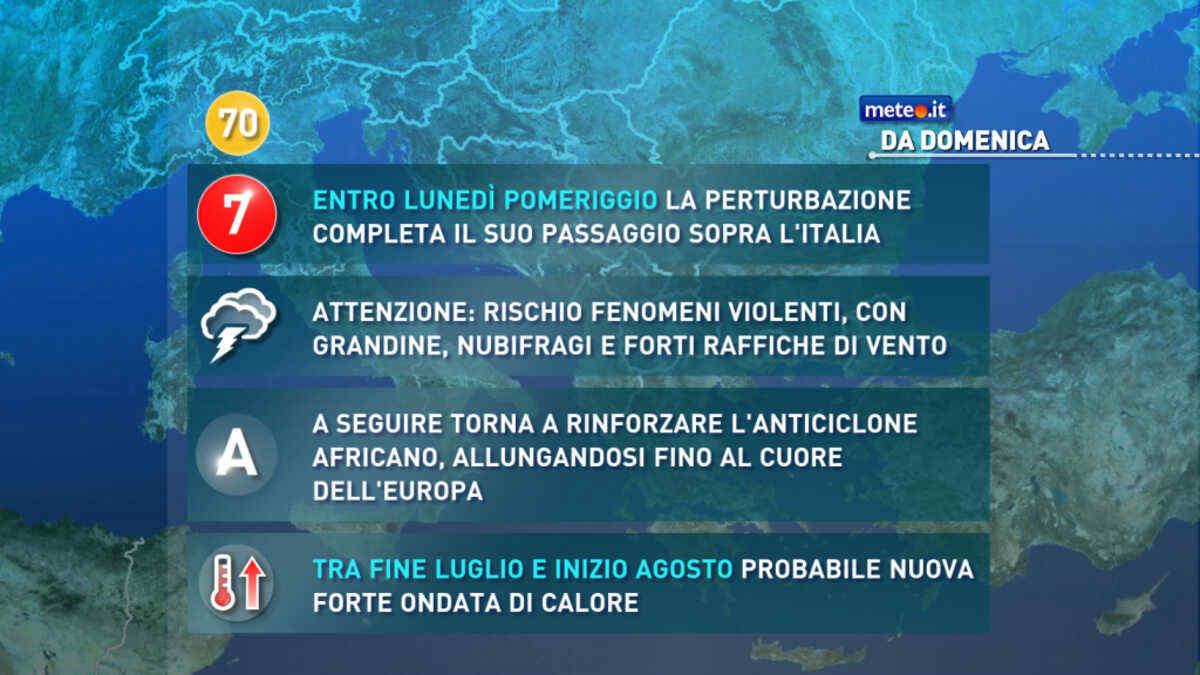
Meteo, nel weekend del 25-26 luglio perturbazione in transito. Stop alla calura
Correnti più fresche di origine nord atlantica riporteranno le temperature su valori prossimi alla norma in tutta la penisola. Perturbazione n.7 in vista


 0
0 58%
58% 8-16 Km/h
 Nord
Nord Nord NE
 Nord E
 Est NE
 Est
Est 6
6 Est SE
 Sud E
Sud E Sud SE
 Sud
Sud Sud SO
 Sud O
Sud O Ovest SO