Al mattino cielo sereno o poco nuvoloso. Temperature minime stazionarie. Nel pomeriggio tempo generalmente soleggiato e molto caldo. Possibili temporali di calore sui rilievi della Calabria e della Basilicata. Temperature massime senza variazioni significative. Venti per lo piu' deboli. Mari poco mossi o calmi.
Meteo, il caldo opprimente proseguirà anche la prossima settimana
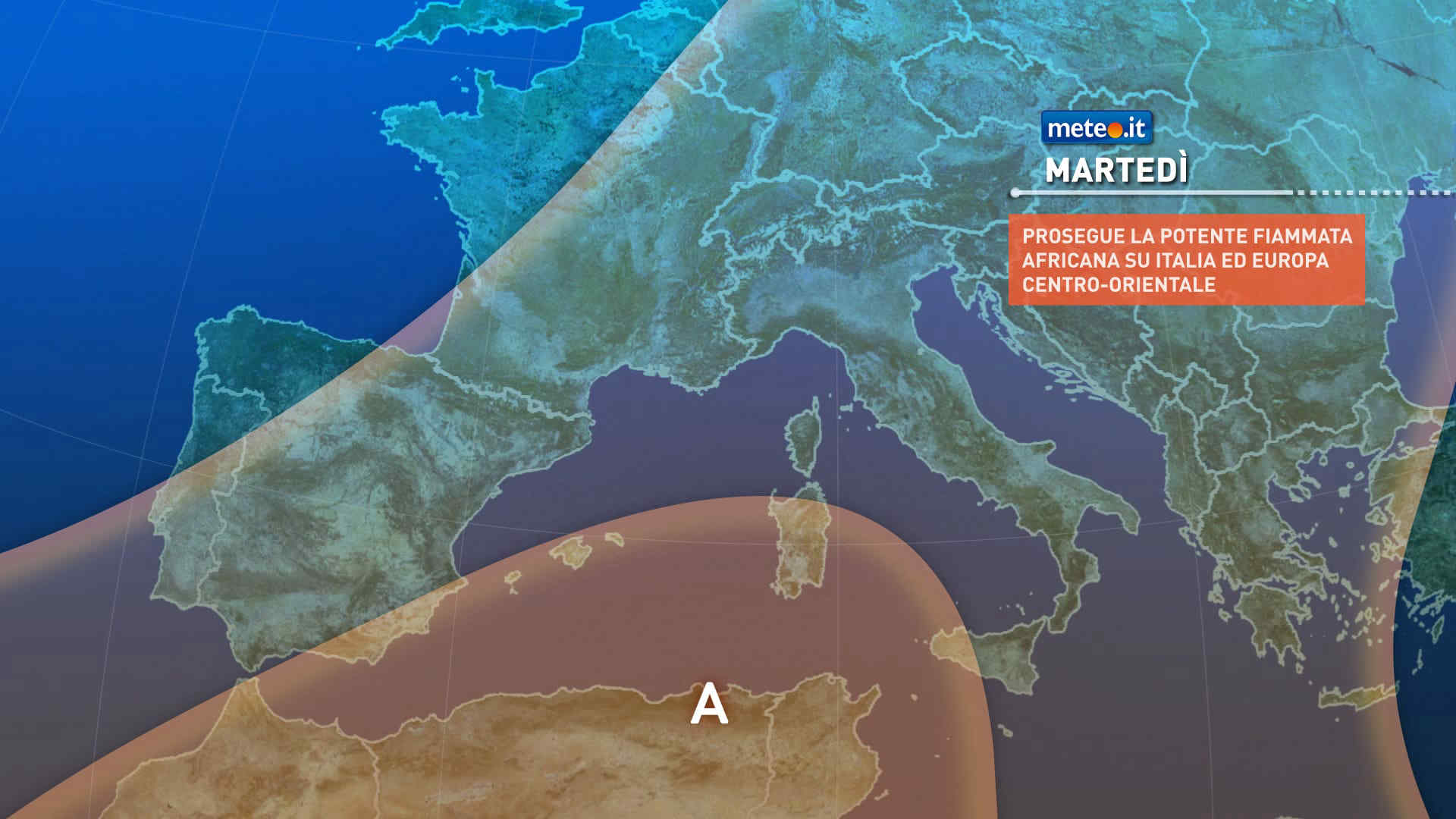
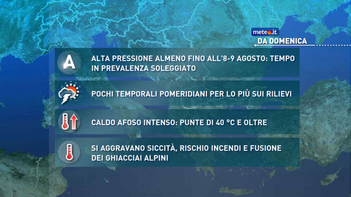
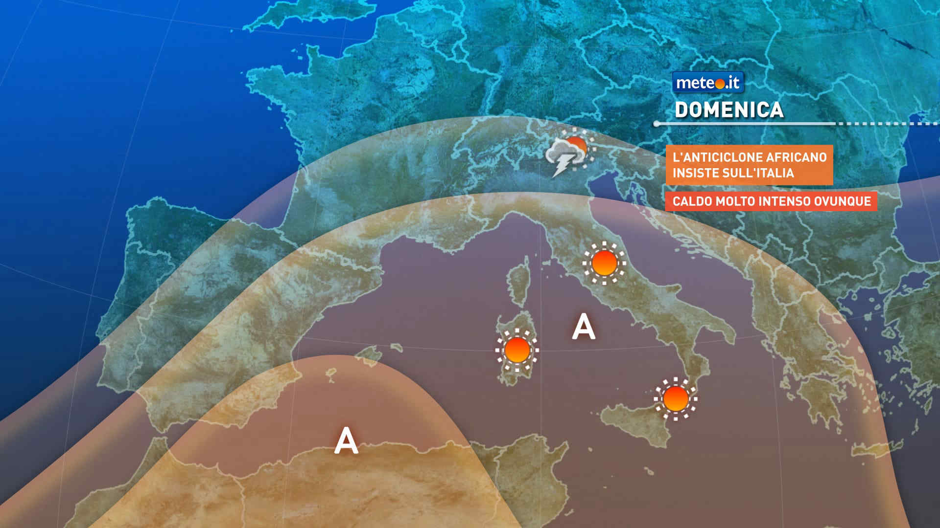
La situazione rimarrà critica sul fronte della siccità, rischio incendi e sofferenza per i ghiacciai con lo zero termico ben oltre 4500 metri. Afa e notti tropicali


 0
0
 71%
71% 6-12 Km/h
 Sud O
Sud O 70%
70% Sud SO
 Ovest SO
 6
6 Ovest
Ovest Ovest NO
 Nord O
 Nord NO