Al mattino cielo sereno. Temperature minime stabili o in lieve calo. Nel pomeriggio tempo soleggiato e molto caldo in tutta la regione. Nelle zone interne montuose temporaneo aumento della nuvolosita' cumuliforme. Temperature massime in leggero calo sul lato orientale dell'isola. Venti per lo piu' deboli. Mari calmi o poco mossi.
Meteo, il caldo opprimente proseguirà anche la prossima settimana
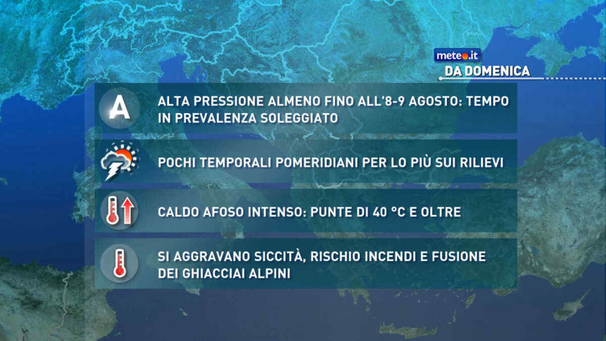
La situazione rimarrà critica sul fronte della siccità, rischio incendi e sofferenza per i ghiacciai con lo zero termico ben oltre 4500 metri. Afa e notti tropicali


 0
0 76%
76% 8-16 Km/h
 Nord NO
 Nord
Nord Nord NE
 Nord E
 67%
67% 6
6 Est NE
 Est
Est Est SE
 Sud E
Sud E Sud SE
 Sud SO
 Sud O
Sud O Ovest SO
 Ovest
Ovest Ovest NO
 Nord O