FacebookInstagramXWhatsApp

Meteo Cucciago tra 7 giorni. Previsioni del tempo, precipitazioni, temperatura e venti

FacebookWhatsappXTelegram

Cucciago
05:57
16:16
Gibbosa calante
Notte
sereno notte
Mattino
soleggiato
Pomeriggio
soleggiato
Sera
sereno notte
  • 21°

    UV Normale 0

    ore

    sereno notte

    Umidità normale51%

    Raffiche normali4-8 Km/h

    Sud sud estSud SE

  • 21°

    UV Normale 0

    ore

    sereno notte

    Umidità normale52%

    Raffiche normali3-7 Km/h

    Sud estSud E

  • 21°

    UV Normale 0

    ore

    sereno notte

    Umidità normale52%

    Raffiche normali3-7 Km/h

    Est sud estEst SE

  • 21°

    UV Normale 0

    ore

    sereno notte

    Umidità normale53%

    Raffiche normali3-6 Km/h

    EstEst

  • 21°

    UV Normale 0

    ore

    sereno notte

    Umidità normale53%

    Raffiche normali3-6 Km/h

    EstEst

  • 21°

    UV Normale 0

    ore

    sereno notte

    Umidità normale52%

    Raffiche normali3-5 Km/h

    Est nord estEst NE

  • 21°

    UV Normale 1

    ore

    soleggiato

    Umidità normale52%

    Raffiche normali3-5 Km/h

    Est nord estEst NE

  • 21°

    UV Normale 2

    ore

    soleggiato

    Umidità normale51%

    Raffiche normali2-5 Km/h

    Est nord estEst NE

  • 21°

    UV Normale 2

    ore

    soleggiato

    Umidità normale51%

    Raffiche normali2-4 Km/h

    Est nord estEst NE

  • 21°

    UV Normale 3

    ore

    soleggiato

    Umidità normale50%

    Raffiche normali2-4 Km/h

    Nord estNord E

  • 21°

    UV Normale 3

    ore

    soleggiato

    Umidità normale48%

    Raffiche normali3-5 Km/h

    Est nord estEst NE

  • 22°

    UV Normale 4

    ore

    soleggiato

    Umidità normale46%

    Raffiche normali3-5 Km/h

    EstEst

  • 22°

    UV Normale 4

    ore

    soleggiato

    Umidità normale45%

    Raffiche normali4-6 Km/h

    Sud estSud E

  • 23°

    UV Normale 5

    ore

    soleggiato

    Umidità normale43%

    Raffiche normali5-7 Km/h

    Sud sud estSud SE

  • 23°

    UV Normale 4

    ore

    soleggiato

    Umidità normale41%

    Raffiche normali5-8 Km/h

    SudSud

  • 23°

    UV Normale 3

    ore

    soleggiato

    Umidità normale42%

    Raffiche normali6-9 Km/h

    Sud ovestSud O

  • 22°

    UV Normale 2

    ore

    soleggiato

    Umidità normale44%

    Raffiche normali6-9 Km/h

    Sud ovestSud O

  • 22°

    UV Normale 1

    ore

    soleggiato

    Umidità normale45%

    Raffiche normali5-8 Km/h

    Sud ovestSud O

  • 22°

    UV Normale 0

    ore

    sereno notte

    Umidità normale46%

    Raffiche normali4-8 Km/h

    Ovest sud ovestOvest SO

  • 22°

    UV Normale 0

    ore

    sereno notte

    Umidità normale47%

    Raffiche normali4-8 Km/h

    Ovest sud ovestOvest SO

  • 21°

    UV Normale 0

    ore

    sereno notte

    Umidità normale49%

    Raffiche normali3-7 Km/h

    OvestOvest

  • 21°

    UV Normale 0

    ore

    sereno notte

    Umidità normale50%

    Raffiche normali3-7 Km/h

    OvestOvest

  • 20°

    UV Normale 0

    ore

    sereno notte

    Umidità normale51%

    Raffiche normali3-7 Km/h

    Ovest nord ovestOvest NO

  • 19°

    UV Normale 0

    ore

    sereno notte

    Umidità normale51%

    Raffiche normali3-7 Km/h

    Nord ovestNord O

  • 21°

    UV Normale 0

    ore

    sereno notte

    Umidità normale52%

    Raffiche normali3-6 Km/h

    NordNord

Meteo provincia di Como
Meteo Nord-Ovest Italia
Oggi

Al mattino prime parziali schiarite tra il basso Piemonte e il Ponente ligure, molte nuvole altrove associate a piogge, piu' diffuse e anche moderate su nord del Piemonte, alta Lombardia e riviera di levante. Temperature minime senza grandi variazioni. Nel pomeriggio nuvole in graduale e parziale attenuazione. Atmosfera instabile con possibili locali rovesci o temporali sulla Lombardia; piogge piu' isolate su alto Piemonte e Levante ligure in esaurimento entro sera. La sera possibile neve fino ai 1600-1800 metri al confine in Valle d'Aosta e sulle Alpi lombarde. Temperature massime in rialzo sul Piemonte e sul Ponente ligure. Venti da moderati a forti di Libeccio in Liguria con mare molto mosso.


Ultime newsVedi tutte


Meteo, due perturbazioni in arrivo tra venerdì 23 ottobre e il weekend
Tendenza20 Ottobre 2026
Meteo, due perturbazioni in arrivo tra venerdì 23 ottobre e il weekend
La tendenza meteo per il weekend mostra uno scenario ancora variabile, con 2 perturbazioni in transito sull'Italia e piogge in diverse regioni
Giovedì tregua dal maltempo, ma ci sono nuove perturbazioni in arrivo verso il weekend. La tendenza dal 22 ottobre
Tendenza19 Ottobre 2026
Giovedì tregua dal maltempo, ma ci sono nuove perturbazioni in arrivo verso il weekend. La tendenza dal 22 ottobre
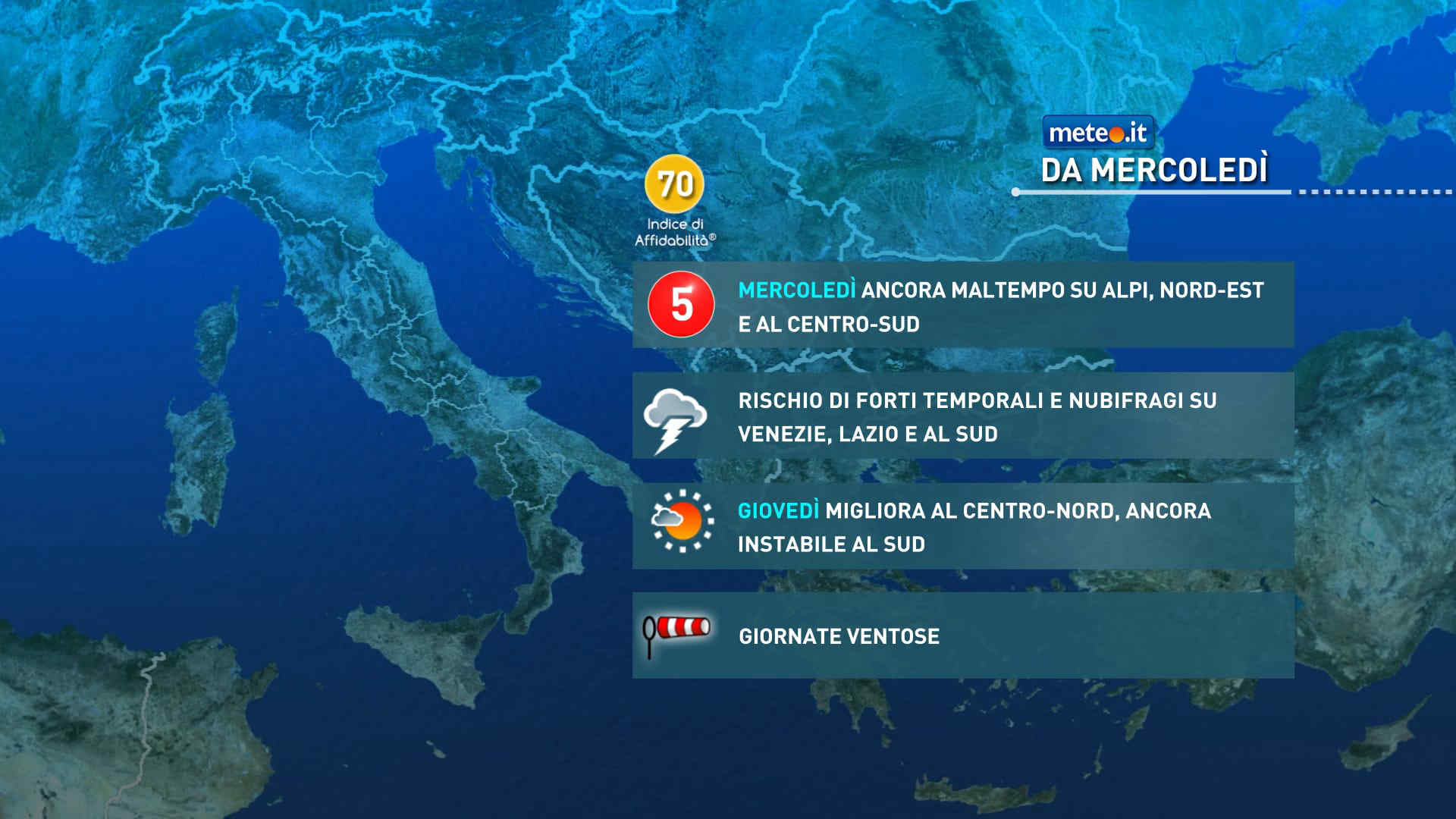
Il forte maltempo che colpirà l'Italia tra martedì e mercoledì si attenuerà nella giornata di giovedì, ma la scena meteo resta dinamica
Meteo: 21 ottobre piogge intense e abbondanti! Occhio ai venti
Tendenza18 Ottobre 2026
Meteo: 21 ottobre piogge intense e abbondanti! Occhio ai venti
La tendenza meteo da mercoledì 21 ottobre vede ancora un forte maltempo con possibili nubifragi e piogge abbondanti. Attenzione anche ai venti.
Mediaset

Ultimo aggiornamento Mercoledì 21 Ottobre ore 00:29

Copyright © 1999-2020 RTI S.p.A. Direzione Business Digital - P.Iva 03976881007 - Tutti i diritti riservati.

Rispetto ai contenuti e ai dati personali trasmessi e/o riprodotti è vietata ogni utilizzazione funzionale all'addestramento di sistemi di intelligenza artificiale generativa. È altresì fatto divieto espresso di utilizzare mezzi automatizzati di data scraping.

Per la pubblicità Mediamond S.p.a. RTI spa, Gruppo Mediaset - Sede legale: 00187 Roma Largo del Nazareno 8 - Cap. Soc. € 500.000.007,00 int. vers. - Registro delle Imprese di Roma, C.F.06921720154