FacebookInstagramTwitterWhatsApp

Meteo Watles tra 9 giorni. Previsioni del tempo, precipitazioni, temperatura e venti

FacebookWhatsappTwitterTelegram

Watles
Notte
nebbia fitta
Mattino
nebbia fitta
Pomeriggio
cielo coperto
Sera
cielo in gran parte nuvoloso
  • UV Normale 0

    ore

    nebbia fitta

    Umidità alta95%

    Raffiche normali4-11 Km/h

    OvestOvest

  • UV Normale 0

    ore

    nebbia fitta

    Umidità alta96%

    Raffiche normali4-10 Km/h

    Ovest nord ovestOvest NO

  • UV Normale 0

    ore

    nebbia fitta

    Umidità alta97%

    Raffiche normali3-8 Km/h

    Ovest nord ovestOvest NO

  • UV Normale 0

    ore

    nebbia fitta

    Umidità alta98%

    Raffiche normali3-7 Km/h

    Ovest nord ovestOvest NO

  • UV Normale 0

    ore

    nebbia fitta

    Umidità alta98%

    Raffiche normali3-7 Km/h

    Ovest nord ovestOvest NO

  • UV Normale 1

    ore

    nebbia fitta

    Umidità alta99%

    Raffiche normali3-7 Km/h

    Ovest nord ovestOvest NO

  • UV Normale 2

    ore

    nebbia fitta

    Umidità alta98%

    Raffiche normali3-7 Km/h

    Ovest nord ovestOvest NO

  • UV Normale 3

    ore

    nebbia fitta

    Umidità alta97%

    Raffiche normali2-7 Km/h

    Ovest nord ovestOvest NO

  • UV Normale 4

    ore

    nebbia fitta

    Umidità alta95%

    Raffiche normali2-6 Km/h

    Ovest nord ovestOvest NO

  • UV Elevato 6

    ore

    nebbia fitta

    Umidità alta94%

    Raffiche normali2-6 Km/h

    Ovest nord ovestOvest NO

  • UV Elevato 7

    ore

    cielo coperto

    Umidità alta94%

    Raffiche normali2-6 Km/h

    Ovest nord ovestOvest NO

  • UV Elevato 8

    ore

    cielo coperto

    Umidità alta94%

    Raffiche normali2-6 Km/h

    Ovest nord ovestOvest NO

  • UV Elevato 9

    ore

    cielo coperto

    Umidità alta94%

    Raffiche normali2-7 Km/h

    Ovest nord ovestOvest NO

  • UV Elevato 10

    ore

    cielo coperto

    Umidità alta95%

    Raffiche normali2-7 Km/h

    Ovest nord ovestOvest NO

  • UV Elevato 9

    ore

    cielo coperto

    Umidità alta95%

    Raffiche normali2-7 Km/h

    Ovest nord ovestOvest NO

  • UV Elevato 7

    ore

    cielo coperto

    Umidità alta95%

    Raffiche normali2-7 Km/h

    Ovest nord ovestOvest NO

  • UV Elevato 6

    ore

    cielo coperto

    Umidità alta95%

    Raffiche normali2-7 Km/h

    Ovest nord ovestOvest NO

  • UV Normale 5

    ore

    cielo in gran parte nuvoloso

    Umidità alta96%

    Raffiche normali2-6 Km/h

    Ovest nord ovestOvest NO

  • UV Normale 4

    ore

    cielo in gran parte nuvoloso

    Umidità alta96%

    Raffiche normali2-6 Km/h

    Nord ovestNord O

  • UV Normale 2

    ore

    cielo in gran parte nuvoloso

    Umidità alta97%

    Raffiche normali1-6 Km/h

    Nord nord ovestNord NO

  • UV Normale 1

    ore

    cielo in gran parte nuvoloso

    Umidità alta97%

    Raffiche normali1-5 Km/h

    Nord nord ovestNord NO

  • UV Normale 0

    ore

    cielo in gran parte nuvoloso

    Umidità alta98%

    Raffiche normali1-5 Km/h

    NordNord

  • UV Normale 0

    ore

    cielo in gran parte nuvoloso

    Umidità alta98%

    Raffiche normali2-6 Km/h

    Nord nord ovestNord NO

  • UV Normale 0

    ore

    cielo in gran parte nuvoloso

    Umidità alta99%

    Raffiche normali2-6 Km/h

    Nord nord ovestNord NO

  • UV Normale 0

    ore

    cielo in gran parte nuvoloso

    Umidità alta99%

    Raffiche normali2-7 Km/h

    Nord ovestNord O

Meteo provincia di Bolzano
Meteo Nord-Est Italia
Oggi

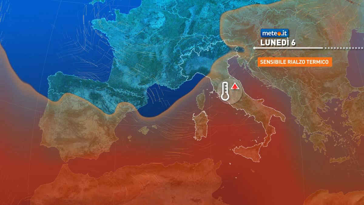
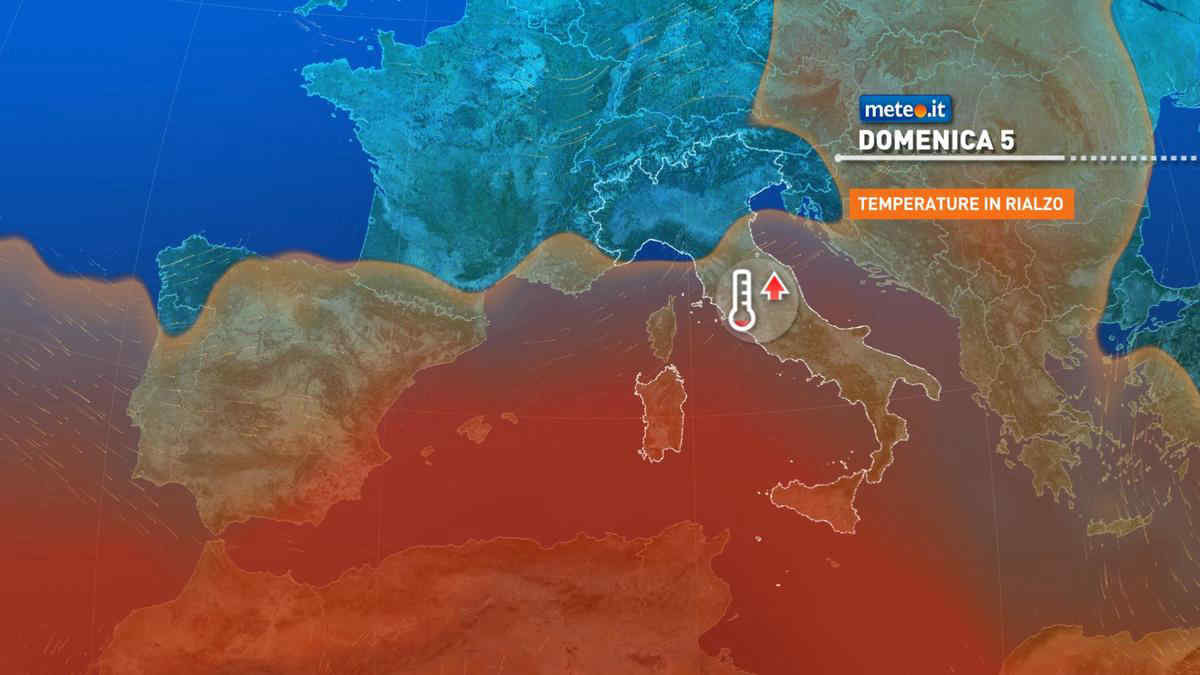
Al mattino cielo in prevalenza nuvoloso ma con tendenza a graduali schiarite. Temperature minime in rialzo. Nel pomeriggio ampie zone soleggiate tra le aree costiere e quelle di pianura. Una maggiore nuvolosita' interessera' le aree montuose ma con basso rischio di precipitazioni. Temperature massime in rialzo con valori intorno ai 20 gradi. Venti deboli o molto deboli. Mare Adriatico calmo o poco mosso.

Notizie
TendenzaMeteo, vortice di bassa pressione porta nuovo maltempo da martedì 7
Meteo, vortice di bassa pressione porta nuovo maltempo da martedì 7
L'alta pressione si allontanerà, spinta verso est da un vortice che in settimana porterà piogge e temporali: la tendenza
Mediaset

Ultimo aggiornamento Sabato 04 Maggio ore 21:22

Copyright © 1999-2020 RTI S.p.A. Direzione Business Digital - P.Iva 03976881007 - Tutti i diritti riservati - Per la pubblicità Mediamond S.p.a. RTI spa, Gruppo Mediaset - Sede legale: 00187 Roma Largo del Nazareno 8 - Cap. Soc. € 500.000.007,00 int. vers. - Registro delle Imprese di Roma, C.F.06921720154